
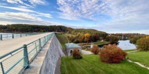
Engineering Ambition and the Flooding of the Swift River Valley
Quabbin Reservoir began as an answer to a metropolitan water crisis. By the late nineteenth and early twentieth centuries, Boston”s population had outgrown the capacity and reliability of its older sources, including local wells, rain barrels, Jamaica Pond, Lake Cochituate, and the Sudbury system. Pollution, epidemics, industrial growth, and the need for dependable fire protection pushed public officials toward larger upland reservoirs connected by aqueducts. The history of Boston”s water system shows a gradual shift from scattered local supplies to an integrated regional network designed around storage, elevation, and gravity.
The Swift River Valley offered the scale that metropolitan planners believed was necessary. Authorized through Massachusetts legislation in the 1920s, the project eventually created a 412-billion-gallon reservoir covering approximately 39 square miles. Yet the engineering achievement depended on an extraordinary social cost. Dana, Enfield, Greenwich, and Prescott were dissolved, their residents displaced, their roads and institutions removed, and their cemeteries relocated. The same protective boundary that extinguished four communities later limited development across a vast watershed, allowing forests and wildlife habitat to recover. Quabbin therefore remains both a monument to public infrastructure and a difficult case study in the ethics of landscape transformation.
The Anatomy of a Reservoir Legislative Mandates and Civil Engineering Scale
The legal architecture came before the concrete. The Ware River Act of 1926 authorized the metropolitan water authorities to develop a new regional supply and divert Ware River flows. The Swift River Act of 1927 extended that ambition into the valley, authorizing the acquisition of land and water rights, construction of dams and aqueducts, issuance of bonds, and use of eminent domain. The extensive legal framework enacted under Massachusetts Chapter 375 established the administrative machinery necessary to reshape the Swift River Valley.
These statutes gave the Metropolitan District Water Supply Commission, or MDWSC, powers that were unusually broad because the project crossed municipal, county, and property boundaries. The acquisition area reached roughly 117 square miles and altered the boundaries of six towns and three counties. The reservoir was initially known as the Swift River Reservoir before its official renaming as Quabbin Reservoir in 1932. In practical terms, the legislation converted a settled valley into a controlled source-water landscape, with land ownership, transportation, settlement, and water flow reorganized around metropolitan demand.
The system”s scale is easiest to understand by separating its major functions. The reservoir stores water, dams control the impounded valley, diversion works bring Ware River water into the system, and aqueducts carry the supply toward eastern Massachusetts. Because the source sits at elevation, much of the distribution system can rely on gravity rather than continuous pumping. That reduces energy requirements and provides hydraulic reliability, although it also places a high premium on protecting the watershed before contamination reaches the reservoir.
| Milestone | Approximate period | Engineering and administrative significance |
|---|---|---|
| Ware River authorization | 1926 | Created statutory authority for regional diversion and water-supply expansion |
| Swift River authorization | 1927 | Enabled land acquisition, dam construction, and transformation of the valley |
| Town dissolution | 1938 | Ended the legal existence of Dana, Enfield, Greenwich, and Prescott |
| Reservoir filling | 1946 | Completed the principal impoundment and established the modern water body |
Construction also became a major Depression-era employment program, placing thousands of workers on roads, dams, aqueducts, clearing operations, and associated facilities. The project”s public benefits were substantial, but the record also includes lawsuits, political patronage, disputes over compensation, and the loss of official records in a 1939 fire. For technical professionals, this combination is instructive: large infrastructure is never only a hydraulic calculation. It is also a legal, financial, political, and property-management system whose consequences extend across generations.
The Mechanics of Disassembly How Four Towns Were Erased
The removal process was systematic rather than spontaneous. Officials first inventoried property, evaluated structures, negotiated or imposed acquisitions, and mapped roads, farms, businesses, schools, churches, mills, and recreational sites. Research held by the Digital Commonwealth engineering archive documents thousands of photographs showing real estate and construction conditions. Approximately 2,500 parcels were acquired, while about 650 houses and the associated institutions and infrastructure of the four towns were displaced.
Residents were given a defined deadline to move homes, businesses, and personal property. Some buildings were relocated, while others were demolished. Roads were cleared, bridges and utility systems were removed or altered, and trees were harvested from the future inundation zone. Clearing served several purposes: it reduced floating debris, limited obstacles within the reservoir, and made construction and filling more manageable. It also stripped the valley of the physical details through which community memory had been organized.
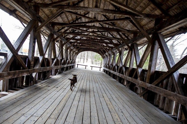
- Surveyors and administrators identified parcels, structures, public facilities, roads, and burial grounds.
- The commission acquired property through purchase or eminent domain and arranged compensation or relocation.
- Residents moved houses, equipment, businesses, and household possessions before the legal dissolution deadline.
- Crews dismantled or removed structures, cleared roads, harvested trees, and prepared the valley for inundation.
- Cemetery teams documented graves and transferred remains to Quabbin Park Cemetery or other designated cemeteries.
The cemetery work was among the most solemn components of the undertaking. Under the governing acts, bodies from cemeteries within the reservoir watershed had to be removed and reinterred. Approximately 7,500 bodies from 34 cemeteries were addressed, with 7,613 often cited in historical accounts, and 945 ultimately transferred to cemeteries outside Quabbin Park Cemetery. The 30-acre Quabbin Park Cemetery in Ware, designed by landscape architect Arthur A. Shurcliff, opened in 1932, while removals continued until 1944. The cemetery documentation collection reveals the administrative precision required to connect old burial plots with new lot numbers and records.
By 1938, roughly 2,700 residents faced the final disappearance of their municipalities. Enfield hosted a last community ball before the towns legally ceased to exist at midnight on April 28. Such ceremonies did not erase the practical necessity of relocation, but they gave residents a public language for grief, anger, and farewell. The valley”s social geography was dismantled even before the water arrived. Flooding began later that year, and the last residents departed by the end of 1938, leaving foundations, roads, cellar holes, cemeteries, and memories beneath or beside the future reservoir.
An Accidental Sanctuary The Biological Evolution of the 56000-Acre Buffer
Quabbin”s ecological legacy emerged from a policy designed primarily for water quality. Once the reservoir and surrounding lands were placed under state control, dense settlement, industrial development, and intensive agriculture were sharply restricted. Former fields and cleared parcels gradually returned to shrubland and forest. Instead of a fragmented pattern of housing, commercial lots, and roads, central Massachusetts gained an unusually broad and connected tract of protected habitat.
The reservoir itself covers about 27,000 acres, while the surrounding protected lands form a much larger buffer. The broader Quabbin Reservoir Watershed Important Bird Area encompasses approximately 145,000 acres across ten towns and three counties. Its connected forests extend toward the Ware River Watershed and Harvard Forest, creating regional movement corridors that are increasingly valuable as development fragments other parts of Massachusetts. The Important Bird Area assessment identifies forests, wetlands, streams, shrublands, and open water as components of a landscape supporting both resident and migratory species.
Wildlife recovery has been visible, although it should not be described as a simple return to an untouched precolonial condition. Habitat composition reflects past agriculture, forestry, reservoir construction, and ongoing management. Even so, reduced development pressure created conditions for species that require large territories, quiet nesting areas, or connected habitat.
- Bald eagles now breed around the reservoir, alongside Common Loons and Pied-billed Grebes.
- Moose and black bears use the extensive forest matrix and its connected travel routes.
- Early-successional shrublands support priority bird species that depend on young forest and recovering fields.
- Wetlands, drawdown zones, and tributary streams provide habitat for birds, amphibians, fish, turtles, and rare plants.
- The watershed supports 35 Partners in Flight priority bird species and documented species such as Wood Turtles and Triangle Floaters.
This is the central ecological paradox of Quabbin. The sanctuary was not established as a biodiversity preserve in the modern sense. It was created through exclusion, regulation, and the displacement of human communities to secure drinking water. Yet those same controls prevented the subdivision and road expansion that have weakened ecological integrity elsewhere. Statewide analysis by Mass Audubon and University of Massachusetts researchers found a 23 percent decline in ecological integrity between 1971 and 2005, driven partly by fragmentation beyond the direct footprint of development. Quabbin”s continuity therefore represents an important conservation asset precisely because it avoids many of those edge effects.
Modern Watershed Protection Balancing Forest Resiliency and Biological Threats
Protection today is active, not merely prohibitive. The Massachusetts Department of Conservation and Recreation”s Division of Water Supply Protection manages more than 100,000 acres of watershed land serving approximately 2.7 million people. DCR foresters use silvicultural practices to maintain source-water quality while building forests with varied ages, tree sizes, species, and structural conditions. The objective is not to maximize timber production or freeze the landscape in one historical state. It is to maintain a resilient forest capable of filtering runoff, storing carbon, supporting wildlife, and recovering from disturbance.
Climate change makes that balance more demanding. A forest with only mature, similarly aged trees can be vulnerable to wind events, pests, drought, and temperature stress. DCR”s model deliberately combines young forest, rapidly growing stands, mature forest, and areas under limited management. Young stands diversify habitat and can reduce vulnerability to large-scale wind damage, growing stands remove atmospheric carbon efficiently, and mature stands provide durable biomass and ecological continuity.
- Use watershed planning and public review to align forestry operations with drinking-water protection.
- Maintain age and species diversity rather than relying on a single uniform forest structure.
- Monitor streams, wetlands, wildlife populations, forest condition, and water-quality indicators.
- Protect additional forest through strategic acquisition to preserve connectivity and prevent development.
- Evaluate carbon in live biomass as well as soils, litter, and deadwood.
The carbon record demonstrates that carefully planned management need not undermine climate benefits. DCR monitoring at Quabbin found average carbon storage rose from 85 tons of carbon dioxide equivalent per acre in 1970 to 153 tons per acre in 2010, despite approximately 1,000 management operations during that period. The 2010 estimate suggests that DCR-owned forests store more than 14 million tons of carbon dioxide in live biomass, with additional storage in soils, litter, and deadwood. Since 1985, nearly 27,500 forested acres have been protected through 613 acquisitions, preventing the release of more than 4 million tons of carbon dioxide associated with development.
Biological threats require the same disciplined monitoring used for engineering assets. In 2023, DCR discovered swollen bladderwort, Utricularia inflata, a non-native floating carnivorous plant in Pottapaug and O”Loughlin Ponds. Fragmentation from propellers, fishing gear, boats, and trailers can spread it, while water movement creates a potential transport route toward Quabbin Reservoir. Dense infestations could alter oxygen conditions, release nutrients, increase algae, and disrupt fish foraging.
Management has included surveys, mechanical removal, restrictions on boat fishing, and a fragment barrier installed in 2025. Removal totals were reported as 115 gallons in 2023, 1,527 gallons in 2024, and 323 gallons in 2025. DCR”s primary objective is preventing establishment in the reservoir, with additional goals of possible eradication at O”Loughlin Pond and continued containment at Pottapaug. The approach illustrates a practical rule for source-water landscapes: early detection, equipment controls, and repeated monitoring are usually safer than waiting for a problem to become widespread and then relying on more disruptive interventions.
Lessons from the Swift River Valley for Future Infrastructure and Conservation
The Quabbin project leaves an ethical question that technical success cannot resolve. Boston gained a dependable, gravity-fed water source, but the gain was funded through the liquidation of four agrarian communities whose residents lost homes, institutions, livelihoods, and local political identity. Compensation and formal procedures could not make that loss equivalent to a financial transaction. For modern planners and engineers, the lesson is not that regional infrastructure should be abandoned. It is that public necessity must be accompanied by transparent valuation, meaningful participation, long-term support for displaced communities, and preservation of records and memory.
Quabbin also shows how strict watershed isolation can produce ecological value that was not the original project”s primary purpose. A protected boundary reduced contamination risk and, over decades, created contiguous habitat, carbon storage, wildlife corridors, and an Important Bird Area. Future projects should integrate these outcomes from the beginning rather than treating conservation as a compensatory afterthought. Clear objectives, adaptive monitoring, climate-resilient design, invasive-species controls, and respect for cultural landscapes can help infrastructure serve both human systems and living ones. The valley”s strongest practical message is equally clear: reliable performance depends on the whole system, including its laws, land, water, communities, forests, and the obligations carried forward by each generation.