
Unlocking the Deep Time Secrets of the Pioneer Valley
The Pioneer Valley is an unusually readable geological landscape. In a relatively compact region of western Massachusetts, hikers can move from red sandstone formed in ancient river systems to dark basalt ridges, then descend toward broad valley-floor deposits left by a vanished glacial lake. The scenery is attractive, but the greater reward comes from recognizing what each surface records: continental breakup, volcanic eruptions, dinosaur activity, ice-sheet retreat, and the reorganization of drainage.
A useful field mindset begins with a simple question: what process could have produced this texture, color, slope, or pattern? The red beds around Sugarloaf point to sediment moving through fault-bounded basins during the breakup of Pangaea. Resistant trap rock explains the dramatic ridges near Holyoke and elsewhere. Flat terraces and finely layered sediments mark the former extent of Glacial Lake Hitchcock. Reading the valley this way turns an ordinary hike into a practical exercise in deep time, with rock exposures serving as field notes written long before humans arrived.
Decoding Mesozoic Rifting in the Red Beds of Sugarloaf Arkose
About 220 million years ago, the supercontinent Pangaea began to fracture as Africa and North America moved apart. The crust did not split along a single clean line. Instead, normal faults created a series of elongated basins, including the Connecticut River Basin. Blocks of crust dropped between the faults, producing low areas where rivers, alluvial fans, lakes, and floodplains accumulated sediment. These basins are often called half-grabens because faulting is concentrated along one major boundary, leaving the basin asymmetrical.
Sugarloaf Arkose records this setting in a particularly visible way. Its red and brown colors come largely from iron oxides formed as sediment weathered in an oxygen-rich environment. The rock is arkose, a sandstone containing abundant feldspar as well as quartz. Feldspar grains and larger angular clasts suggest that the source rocks were not transported and weathered for an extremely long time before deposition. Nearby uplands were being eroded, and sediment was delivered into the developing basin relatively quickly. For broader background on these fault-bounded basins and the Atlantic-margin rift system, consult this Geology of the New York City Region.
At an outcrop, the goal is not to identify a single diagnostic grain and declare success. Use several observations together. A braided-stream interpretation becomes more convincing when the following features occur in combination:
- Coarse clasts near the base: Pebbles and cobbles, especially angular or poorly rounded fragments, indicate energetic flow close to a sediment source.
- Rapidly changing bed thickness: Braided channels migrate repeatedly, producing lenses and beds that pinch out over short distances.
- Cross-bedding: Inclined internal layers record dunes or bars migrating downstream. Measure the apparent direction of the inclined layers, while remembering that later tilting can alter their present orientation.
- Mixed grain sizes: Sandstone beds interrupted by conglomeratic layers suggest fluctuating discharge and shifting channels rather than quiet, uniform deposition.
- Red coloration throughout the exposure: Consistent oxidation supports subaerial or seasonally exposed conditions, although color alone is not proof of a particular environment.
Begin by viewing the exposure from several meters away to map its broad geometry. Then inspect a fresh, naturally broken surface with a hand lens. Look for feldspar grains that are commonly pale pink, cream, or white, and compare their angularity with the more rounded quartz grains. Finally, trace individual beds laterally. If inclined layers, coarse channel fills, and erosional contacts repeatedly appear together, the outcrop is telling a coherent braided-stream story rather than presenting random visual variation.
Tracking Early Dinosaurs along Mudflats and Quarry Slabs
The early Jurassic Connecticut River Valley was not a single uniform desert. It included shallow lakes, floodplains, river channels, alluvial fans, and periodically exposed mudflats. Seasonal wetting and drying created surfaces capable of preserving footprints, while later burial protected them from erosion. The valley”s rift-basin setting also helped preserve sediment in accommodation space, allowing successive layers to accumulate over long intervals.
Footprints are trace fossils, meaning they record behavior rather than the animal”s body directly. A trackway can reveal direction, stride, speed, posture, and whether an animal walked steadily or paused. Large tridactyl tracks commonly assigned to Eubrontes show three robust forward-pointing digits and a substantial heel region. Smaller, more delicate three-toed tracks commonly associated with Grallator tend to have narrower impressions and a lighter appearance. These names are practical track classifications, not necessarily direct identifications of a particular dinosaur species.
The Connecticut River Valley”s importance as an early vertebrate trackway corridor is well documented in The Connecticut River Valley. At the Lily Pond Dinosaur Quarry in Barton Cove, visitors can encounter slabs associated with one of the region”s earliest and richest track-discovery areas. A flat rock embedded in the trail can provide a useful comparison surface, while the quarry”s exposed slabs show how waterfalls and erosion can reveal ancient bedding planes. At public footprint sites in Holyoke, the most responsible approach is careful observation rather than touching, casting, or attempting to remove material.
| Track type | Typical visual scale | Digit arrangement | What the trackway may indicate |
|---|---|---|---|
| Grallator | Small, often narrow impressions | Three slender forward-pointing toes, usually with a compact heel | A relatively small biped moving across a soft surface |
| Eubrontes | Medium to large tridactyl tracks | Three broad toes with a stronger central digit and deeper impression | A larger, active biped with a substantial stride |
| Large tridactyl forms | Very broad or elongated prints | Deep three-toed impressions, sometimes with a pronounced heel | A large animal, with stride length and track depth offering clues to movement |
| Trackway series | Repeated footprints rather than one print | Alternating left and right impressions | Direction, pace, turning, pauses, and surface conditions |
For field interpretation, photograph the track with a scale object placed beside it, not on top of it. Record the number of toes, the apparent direction of travel, the spacing between successive prints, and whether the sediment surface shows ripples, cracks, or raindrop marks. Those associated features matter because a footprint is most informative when its environmental setting is considered alongside its anatomy.
Following the Trap Rock Ridges of the Holyoke Basalt Flow
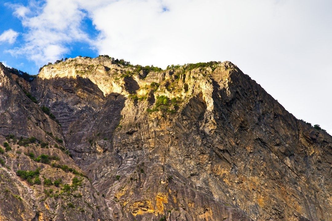
The dark ridges of the valley formed during episodes of intense basaltic volcanism associated with the Central Atlantic Magmatic Province. As rifting progressed, enormous volumes of magma rose through fractures and spread across the developing landscape. Once cooled, basalt became more resistant to erosion than the surrounding sedimentary rocks. Later weathering therefore removed softer sandstone and shale more quickly, leaving ridges, cliffs, and cuesta-like landforms.
Holyoke Basalt is especially instructive because its internal cooling structures remain visible. Thick flows may develop columnar joints, fractures that divide the rock into polygonal columns as it contracts. These columns are not carved blocks; they are cooling features that formed naturally. Below cliffs, angular talus accumulates as joint-bounded pieces detach. Surface weathering can produce brown, orange, or reddish rinds, while fresher interior surfaces remain dark gray to black. The contrast is most useful when examined across several fragments rather than inferred from a single weathered stone.
When searching for the contact between basalt and underlying sedimentary rock, use a systematic checklist:
- Look for a change from dark, fine-grained, crystalline rock to red, tan, or gray sandstone and shale.
- Search for a baked zone in the sedimentary rock. Heat from the intrusion or lava flow may harden, discolor, or recrystallize the uppermost beds.
- Check for a chilled basalt margin, where the lava cooled rapidly and became finer grained than the interior.
- Inspect the contact for irregularity, brecciation, or small fragments of sediment caught within basalt.
- Compare slope behavior. Resistant basalt commonly forms a steep wall or ledge, while softer shale beneath it may create a bench or recessed slope.
Not every dark boulder is necessarily local basalt, and not every sharp boundary is a volcanic contact. Glacial transport can scatter rock far from its source, while faults can place unrelated units beside each other. Reliable interpretation comes from continuity: follow the layer along the exposure, compare grain size and texture, and use a map or cross-section to test whether the observed boundary fits the regional structure.
Tracing Glacial Lake Hitchcock in the Modern Valley Floor
After the last major ice advance, retreating glaciers left enormous quantities of sediment and temporarily blocked the Connecticut River drainage. The resulting Glacial Lake Hitchcock extended through much of the valley. The lake was not static. Its shoreline shifted, deltas advanced, river channels entered and exited the basin, and sediment accumulated in water that could be quiet in one location and turbulent in another. Field-trip studies of the valley describe lake sediments reaching roughly 30 to 40 meters in thickness in places, helping explain the broad, unusually flat valley floor.
The clearest lake deposits are often varves, rhythmic layers of silt and clay produced by seasonal changes in sediment delivery. A lighter, coarser summer layer may be paired with a darker, finer winter layer, although color and texture vary according to local conditions. Delta terraces tell a different part of the story. Where streams entered the lake, their sediment spread outward and built flat-topped deposits. Later incision left those former lake margins perched above modern channels. Roadcuts and river bluffs can expose these materials, but unstable slopes require distance and caution.
Use the following procedure to distinguish laminated lake sediment from coarse river outwash:
- Start with grain size. Rub a small loose fragment between gloved fingers. Clay and silt feel smooth, while sand and gravel feel distinctly gritty. Do not scrape intact exposures.
- Examine layering. Lake sediment commonly shows repeated, thin, laterally continuous laminae. Outwash more often contains beds of sand and gravel with irregular lenses and channel-shaped contacts.
- Check clast support. In coarse outwash, pebbles may touch one another within a gravel framework. Fine lake deposits form a compact matrix with few or no large clasts.
- Look for sorting changes. A sharp transition from fine laminae to sand or gravel can indicate a delta front, flood event, or channel migration.
- Compare several points along the exposure. A single patch can mislead. Continuity across the bluff is stronger evidence for a lake-bed sequence or terrace surface.
Distorted or folded laminae do not automatically mean tectonic deformation. Subaqueous slumping, loading, or rapid sediment failure can disturb otherwise horizontal lake beds. A topographic map adds another useful check: broad, level surfaces at consistent elevations may represent former lake terraces, while narrow, irregular benches are more likely to reflect river incision or local slope processes.
Plan Your Own Geological Traverse Across the Valley
A good traverse does not require expensive equipment. The essential aim is to connect observations made at separate stops. A route might begin with red arkose and conglomerate, continue toward a basalt ridge, and finish on a valley-floor terrace where lake sediment is exposed. Check current access conditions, parking rules, trail status, and site restrictions before setting out. Public fossil localities can have limited parking or seasonal closures, and exposed rock may become hazardous when wet, icy, or unstable.
- Hand lens: Use it to distinguish feldspar, quartz, weathered basalt, and fine sediment textures.
- Topographic map and cross-section: These help relate ridges, terraces, faults, and valley floors.
- Field notebook: Record location, rock type, bedding orientation, grain size, color, and uncertainty.
- Scale and camera: Photograph tracks, clasts, and layering with a ruler or familiar object nearby.
- Safety equipment: Wear sturdy footwear, carry water, and avoid approaching unstable quarry walls or undercut bluffs.
Leave-no-trace paleontology is particularly important because a footprint can lose much of its scientific value if its position, orientation, or surrounding surface is damaged. Do not hammer, pry, chalk, cast, or remove material from protected or public fossil sites. Keep feet off track surfaces, stay on designated paths, and report notable observations through the appropriate site or institutional channel rather than collecting privately. The practical next step is simple: choose one accessible exposure, write down what is visible before consulting a guide, and then test that first interpretation against the valley”s larger geological history.
The Pioneer Valley rewards clear observation. Red beds preserve the mechanics of rifting and ancient river flow; trap rock records fire and cooling; dinosaur tracks capture movement across temporary mudflats; and glacial terraces reveal a drainage system repeatedly reshaped by ice and water. Once these clues become familiar, the landscape stops looking like a collection of scenic viewpoints and begins to read as a continuous field narrative stretching across more than 200 million years.