
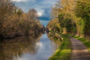
Rediscovering America’s First Great Engineering Corridor
The Middlesex Canal was an audacious answer to a practical problem: how could the growing communities and mills of the Merrimack Valley move heavy goods to Boston without relying on rough roads, seasonal river conditions, and costly wagon transport? Chartered in 1793 and completed in 1803, the 27-mile waterway connected the Merrimack River near Lowell with Boston Harbor at Charlestown. Today, following its surviving traces offers a clear signal from the past, showing how transportation infrastructure can shape settlement, industry, and future corridors for centuries.
For hikers, the canal is an unusually accessible engineering classroom. The route crossed undeveloped terrain, climbed and descended a total of roughly 107 feet, and depended on careful surveying, controlled water levels, locks, embankments, aqueducts, and towpaths. The builders worked before modern laser levels, digital mapping, heavy earthmoving equipment, or standardized structural design manuals. Their solution was not a single spectacular structure, but a coordinated regional system in which many modest components had to perform reliably together.
Tracing the surviving canal corridor through Billerica, Wilmington, Woburn, the Mystic Lakes basin, and Charlestown reveals more than isolated ruins. The dry ditch profiles, granite abutments, millponds, and preserved towpath sections explain why later railroads and highways favored similar alignments. The canal is therefore both an outdoor heritage route and an open-air blueprint for understanding modern transit geography.
Precision Surveying and Hydraulic Architecture in the 1790s
The incorporation of the Proprietors of the Middlesex Canal by the Massachusetts General Court on June 22, 1793, launched one of the most demanding private infrastructure projects in the young United States. Surveyors had to identify a workable route across virgin or lightly developed terrain, acquire 142 parcels of land, estimate excavation volumes, and establish a dependable water supply. Their instruments were comparatively basic, but the design problem was exacting. A small error in grade could leave a section too shallow for navigation, drain a summit level, or create damaging flows through an embankment.
The canal followed a carefully controlled profile rather than simply tracking the lowest ground. Its central water supply came from the Concord River summit level near North Billerica. From there, water moved in opposite directions, descending through lock chambers toward the Merrimack River and toward Charlestown. Twenty locks managed the total rise and fall. Granite masonry, timber components, clay-lined channels, and hydraulic cement helped create chambers capable of holding back water and surviving repeated cycles of filling, emptying, and impact from canal boats.
Contemporary canal dimensions reflected a balance between construction cost and commercial capacity. The following comparison provides useful scale, although exact measurements varied along the route and among different historical accounts.
| Feature | Middlesex Canal | Engineering significance |
|---|---|---|
| Route length | More than 27 miles | Created a continuous inland connection between the Merrimack Valley and Boston Harbor |
| Total elevation change | Approximately 107 feet | Required a chain of locks rather than a single steep grade |
| Lock system | Twenty chambers | Divided the climb and descent into manageable hydraulic steps |
| Water supply | Concord River summit level | Fed canal sections in both directions |
| Transport mode | Horse-drawn barges and passenger boats | Moved bulk cargo more efficiently than contemporary roads |
The canal’s importance is best understood as a systems achievement. Surveying determined the grade, masonry contained the water, locks converted elevation into manageable stages, and towpaths allowed animals to pull barges steadily. The Middlesex Canal Association’s historical overview records how these elements supported a major transportation route before railroads could offer greater speed and carrying capacity.
Granite Aqueducts and Water Supply Engineering at North Billerica
North Billerica was the hydraulic center of the canal. The Concord River summit level functioned as a reservoir and distribution zone, sending water north toward the Merrimack and south toward Charlestown. This arrangement required more than a channel cut through the landscape. Engineers had to protect the canal from uncontrolled stream flows, maintain navigable depth, and prevent natural rivers from mixing with or damaging the canal prism.
Aqueducts solved the most difficult crossings. Instead of allowing a river to enter the canal, the canal was carried over or across the watercourse in a controlled masonry structure. The aqueduct over the Shawsheen River was particularly notable, with granite elements and abutments that demonstrated how local stone could provide durable structural support. The canal also used embankments, clay lining, and a floating towpath, an arrangement in which the towpath was supported along difficult wet or unstable ground rather than simply laid on solid natural terrain.
- Summit control: The Concord River supplied the high-level section from which water descended in two directions.
- Aqueduct protection: Masonry crossings kept river water separate from the navigable canal channel.
- Floating towpath construction: Timber and earthwork solutions allowed draft animals to pull boats across challenging ground.
- Lock coordination: Gates and chambers regulated water movement while also lifting and lowering cargo boats.
- Industrial integration: Mills and landing areas connected water control with loading, processing, and distribution.
The Faulkner Mills site illustrates this relationship between hydraulic engineering and industrial logistics. A millpond was not merely scenery. It represented stored energy, regulated water, and a point where canal activity could connect with manufacturing. Visitors to the Association’s museum and visitor center can see artifacts, models, and nearby remnants that make the relationship between water management and freight movement easier to understand. The Association notes that its museum generally operates on weekends, although visitors should verify current hours before planning a trip.
That practical connection remains relevant to modern infrastructure planning. A canal could not be treated as an isolated trench, just as a contemporary transit line cannot be planned without considering drainage, flood storage, land ownership, utility conflicts, and access to destinations. The Billerica remnants show how successful infrastructure depends on interfaces, the places where water, land, industry, and movement meet.
How Barge Routes Prefigured Modern Rail and Highway Networks
The canal changed the economics of regional trade by allowing bulk materials to move directly toward Boston. Lumber, granite, agricultural products, and other heavy commodities could travel by barge, while manufactured goods moved north toward communities along the Merrimack. The route linked inland production with Boston’s port and helped support the industrial development that later made Lowell a leading textile center. The National Park Service account of the Merrimack River places this transportation network within the broader transformation of the river into an industrial and power corridor.
The canal also encouraged specialized activity along its route. Woburn, for example, benefited from access that supported leather tanning and other commercial operations. For approximately half a century, the waterway provided relatively safe and economical movement for both freight and passengers. Its limitation was capacity. Railroads could carry substantially larger loads, operate faster, and avoid the operational delays associated with locks, freezing, leakage, and water-level management. Canal operations ended in 1851 after the Boston and Lowell Railroad displaced the water route as the dominant connection.
The railroad’s success did not erase the canal’s geography. It reinforced it. A canal already represented a valuable corridor with relatively gentle grades, established rights-of-way, access to settlements, and known engineering conditions. The Boston and Lowell Railroad adopted much of the canal’s alignment and grade, demonstrating a recurring infrastructure principle: later systems often follow earlier corridors because the first builders have already solved difficult topographic and property problems.
- Canal period: Horse-drawn barges moved heavy cargo with low rolling resistance on water.
- Rail period: Tracks used established transportation geography while increasing speed and payload.
- Highway period: Route 3 and Interstate 93 followed broader regional movement patterns between the Merrimack Valley and Boston.
- Modern planning: Historic corridors can support trails, transit connections, utility routes, and greenways when protected from fragmented development.
Route 3 and Interstate 93 are not literal replacements for every foot of canal, but they occupy the same powerful regional logic. Both connect northern communities with Boston, follow the broad lowland geography of the Middlesex and Merrimack region, and concentrate development around efficient movement. Archival records held through the UMass Lowell canal collection help document this transition through maps, proprietors’ records, photographs, correspondence, and barge-related materials.
A Field Guide to Navigating the Surviving Canal Waypoints
The canal is not preserved as one uninterrupted hiking trail. Its remains are distributed across developed suburbs, parks, private property, road crossings, wetlands, and industrial areas. A successful visit therefore requires route planning rather than assumption. Historic maps, municipal trail information, and current access rules should be checked before departure, because a visible remnant may not be an open public path.
The most useful approach is to treat the corridor as a sequence of engineering stations. At each stop, look for the relationship between the surviving structure and the surrounding landscape. A ditch profile indicates the canal prism, a granite block may mark an aqueduct abutment, and a level terrace may reveal a towpath even when the water channel has disappeared.
- Begin at the Concord River mill pond and Faulkner Mills. Start at the Middlesex Canal Visitor Center in North Billerica, where exhibits and working models provide context for the canal’s locks, boats, and water system. Examine the millpond as a controlled hydraulic landscape, then look for nearby traces of the floating towpath anchorage and timber-lock construction.
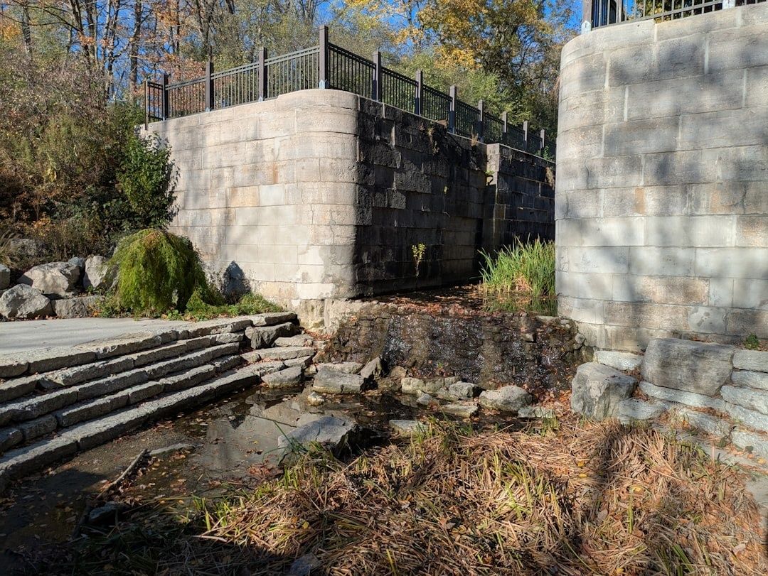
- Inspect the Shawsheen River crossing in Wilmington. Surviving granite abutments and aqueduct remnants show how the canal crossed a natural river without surrendering control of its water level. Compare the elevation of the canal route with the river channel below, and observe how modern roads and drainage have altered the setting.
- Follow the dry ditch profiles through Woburn. In developed areas, the canal may appear as a shallow depression, straight property boundary, wooded strip, or unusually level corridor. These features make sense when viewed as parts of a continuous route rather than as unrelated landscape details.
- Continue toward the Mystic Lakes basin and Charlestown. The southern approach demonstrates how the canal entered the Boston metropolitan landscape. Pay attention to low ground, ponds, road crossings, and industrial land, all of which influenced the original route and later transportation development.
A practical field checklist improves both safety and historical accuracy. Carry a charged phone with offline waypoint maps, a backup power source, water, weather-appropriate clothing, and footwear suited to mud or uneven ground. An elevation app or simple topographic map is especially useful because the canal’s engineering story is fundamentally about grade. Even a modest rise becomes meaningful when considered alongside the twenty-lock system that once managed the route.
Historic trail etiquette matters. Stay on public paths, avoid climbing unstable masonry, do not remove stones or artifacts, and respect private property and active industrial sites. Wetlands may contain concealed channels, and old embankments can be fragile. Photographs, measured observations, and geotagged notes can support preservation, but sensitive archaeological details should not be publicized in ways that encourage vandalism. The Middlesex Canal Association remains a useful starting point for museum information, events, volunteer opportunities, and restoration updates.
Preserving America’s Open Air Transit Blueprint for the Future
The Middlesex Canal Association and regional conservation partners have helped move the canal from obscurity toward active interpretation. Their work includes clearing selected sections, operating a replica barge, maintaining museum programs, documenting surviving features, and advocating for heritage parks. Proposed reconstruction and restoration have faced funding and coordination challenges, but the central objective remains practical: protect enough of the alignment to make the canal’s engineering logic legible to the public.
That objective aligns naturally with modern greenway development. Canal and railroad corridors tend to be comparatively level, direct, and separated from motor traffic, which makes them valuable for walking and cycling connections. Groups such as Friends of Regional Trails and Towpaths have promoted the use of historic transportation rights-of-way to link existing and planned trails between Lowell, Chelmsford, and Billerica. For planners, hikers, and civil engineering advocates, the next practical step is to visit responsibly, support documentation and conservation, and treat each remaining segment as infrastructure evidence rather than decorative ruin. Preserving the alignment keeps an early American transit blueprint available for the next generation of regional mobility decisions.