



Fossilized bird-like dinosaur skeleton preserved in a stone slab

Reading the Pioneer Valley: A Field Guide to Dinosaur Tracks, Basalt Ridges, and Lost Lakes

Unlocking the Deep Time Secrets of the Pioneer Valley

The Pioneer Valley is an unusually readable geological landscape. In a relatively compact region of western Massachusetts, hikers can move from red sandstone formed in ancient river systems to dark basalt ridges, then descend toward broad valley-floor deposits left by a vanished glacial lake. The scenery is attractive, but the greater reward comes from recognizing what each surface records: continental breakup, volcanic eruptions, dinosaur activity, ice-sheet retreat, and the reorganization of drainage.

A useful field mindset begins with a simple question: what process could have produced this texture, color, slope, or pattern? The red beds around Sugarloaf point to sediment moving through fault-bounded basins during the breakup of Pangaea. Resistant trap rock explains the dramatic ridges near Holyoke and elsewhere. Flat terraces and finely layered sediments mark the former extent of Glacial Lake Hitchcock. Reading the valley this way turns an ordinary hike into a practical exercise in deep time, with rock exposures serving as field notes written long before humans arrived.

Decoding Mesozoic Rifting in the Red Beds of Sugarloaf Arkose

About 220 million years ago, the supercontinent Pangaea began to fracture as Africa and North America moved apart. The crust did not split along a single clean line. Instead, normal faults created a series of elongated basins, including the Connecticut River Basin. Blocks of crust dropped between the faults, producing low areas where rivers, alluvial fans, lakes, and floodplains accumulated sediment. These basins are often called half-grabens because faulting is concentrated along one major boundary, leaving the basin asymmetrical.

Sugarloaf Arkose records this setting in a particularly visible way. Its red and brown colors come largely from iron oxides formed as sediment weathered in an oxygen-rich environment. The rock is arkose, a sandstone containing abundant feldspar as well as quartz. Feldspar grains and larger angular clasts suggest that the source rocks were not transported and weathered for an extremely long time before deposition. Nearby uplands were being eroded, and sediment was delivered into the developing basin relatively quickly. For broader background on these fault-bounded basins and the Atlantic-margin rift system, consult this Geology of the New York City Region.

At an outcrop, the goal is not to identify a single diagnostic grain and declare success. Use several observations together. A braided-stream interpretation becomes more convincing when the following features occur in combination:

  • Coarse clasts near the base: Pebbles and cobbles, especially angular or poorly rounded fragments, indicate energetic flow close to a sediment source.
  • Rapidly changing bed thickness: Braided channels migrate repeatedly, producing lenses and beds that pinch out over short distances.
  • Cross-bedding: Inclined internal layers record dunes or bars migrating downstream. Measure the apparent direction of the inclined layers, while remembering that later tilting can alter their present orientation.
  • Mixed grain sizes: Sandstone beds interrupted by conglomeratic layers suggest fluctuating discharge and shifting channels rather than quiet, uniform deposition.
  • Red coloration throughout the exposure: Consistent oxidation supports subaerial or seasonally exposed conditions, although color alone is not proof of a particular environment.

Begin by viewing the exposure from several meters away to map its broad geometry. Then inspect a fresh, naturally broken surface with a hand lens. Look for feldspar grains that are commonly pale pink, cream, or white, and compare their angularity with the more rounded quartz grains. Finally, trace individual beds laterally. If inclined layers, coarse channel fills, and erosional contacts repeatedly appear together, the outcrop is telling a coherent braided-stream story rather than presenting random visual variation.

Tracking Early Dinosaurs along Mudflats and Quarry Slabs

The early Jurassic Connecticut River Valley was not a single uniform desert. It included shallow lakes, floodplains, river channels, alluvial fans, and periodically exposed mudflats. Seasonal wetting and drying created surfaces capable of preserving footprints, while later burial protected them from erosion. The valley”s rift-basin setting also helped preserve sediment in accommodation space, allowing successive layers to accumulate over long intervals.

Footprints are trace fossils, meaning they record behavior rather than the animal”s body directly. A trackway can reveal direction, stride, speed, posture, and whether an animal walked steadily or paused. Large tridactyl tracks commonly assigned to Eubrontes show three robust forward-pointing digits and a substantial heel region. Smaller, more delicate three-toed tracks commonly associated with Grallator tend to have narrower impressions and a lighter appearance. These names are practical track classifications, not necessarily direct identifications of a particular dinosaur species.

The Connecticut River Valley”s importance as an early vertebrate trackway corridor is well documented in The Connecticut River Valley. At the Lily Pond Dinosaur Quarry in Barton Cove, visitors can encounter slabs associated with one of the region”s earliest and richest track-discovery areas. A flat rock embedded in the trail can provide a useful comparison surface, while the quarry”s exposed slabs show how waterfalls and erosion can reveal ancient bedding planes. At public footprint sites in Holyoke, the most responsible approach is careful observation rather than touching, casting, or attempting to remove material.

Track type Typical visual scale Digit arrangement What the trackway may indicate
Grallator Small, often narrow impressions Three slender forward-pointing toes, usually with a compact heel A relatively small biped moving across a soft surface
Eubrontes Medium to large tridactyl tracks Three broad toes with a stronger central digit and deeper impression A larger, active biped with a substantial stride
Large tridactyl forms Very broad or elongated prints Deep three-toed impressions, sometimes with a pronounced heel A large animal, with stride length and track depth offering clues to movement
Trackway series Repeated footprints rather than one print Alternating left and right impressions Direction, pace, turning, pauses, and surface conditions

For field interpretation, photograph the track with a scale object placed beside it, not on top of it. Record the number of toes, the apparent direction of travel, the spacing between successive prints, and whether the sediment surface shows ripples, cracks, or raindrop marks. Those associated features matter because a footprint is most informative when its environmental setting is considered alongside its anatomy.

Following the Trap Rock Ridges of the Holyoke Basalt Flow

The dark ridges of the valley formed during episodes of intense basaltic volcanism associated with the Central Atlantic Magmatic Province. As rifting progressed, enormous volumes of magma rose through fractures and spread across the developing landscape. Once cooled, basalt became more resistant to erosion than the surrounding sedimentary rocks. Later weathering therefore removed softer sandstone and shale more quickly, leaving ridges, cliffs, and cuesta-like landforms.

Holyoke Basalt is especially instructive because its internal cooling structures remain visible. Thick flows may develop columnar joints, fractures that divide the rock into polygonal columns as it contracts. These columns are not carved blocks; they are cooling features that formed naturally. Below cliffs, angular talus accumulates as joint-bounded pieces detach. Surface weathering can produce brown, orange, or reddish rinds, while fresher interior surfaces remain dark gray to black. The contrast is most useful when examined across several fragments rather than inferred from a single weathered stone.

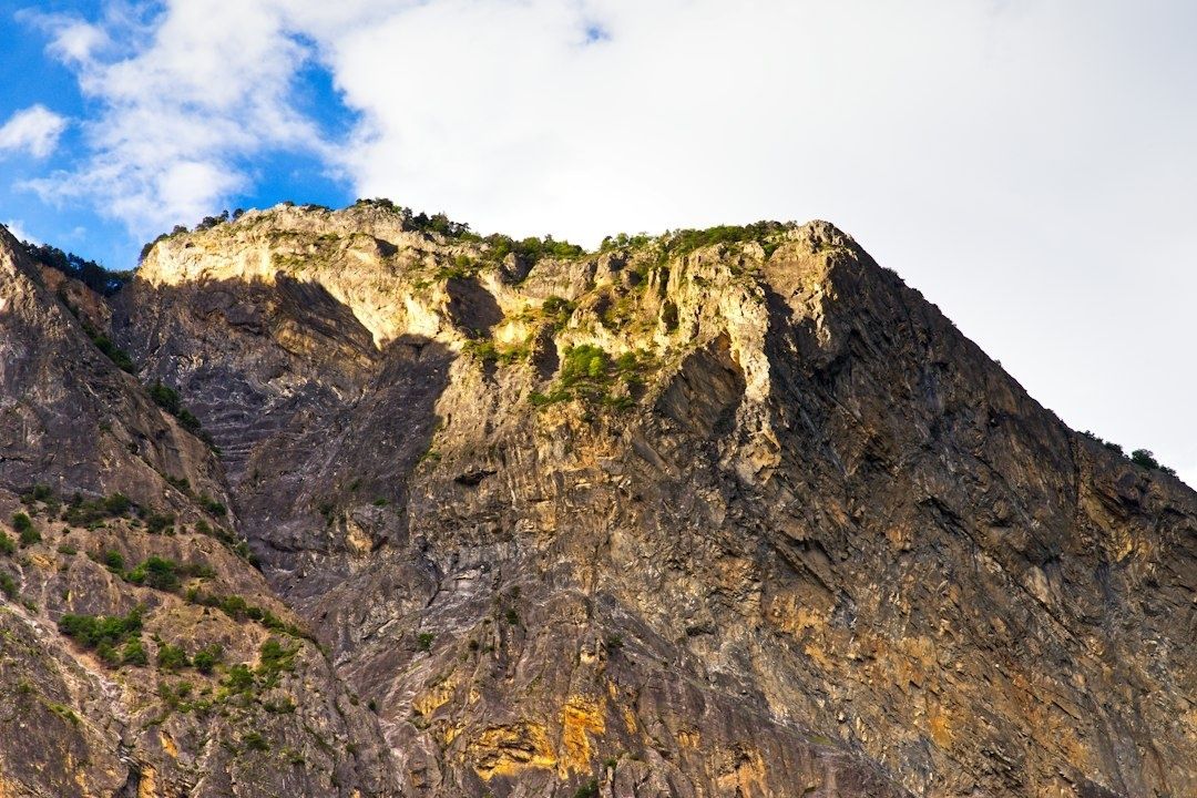
Sunlit, rugged basalt cliff ridge beneath a partly cloudy blue sky
Resistant basalt preserves the valley”s volcanic history by weathering more slowly than the surrounding sedimentary rocks, creating the ridges and cliffs that shape the modern landscape.

When searching for the contact between basalt and underlying sedimentary rock, use a systematic checklist:

  • Look for a change from dark, fine-grained, crystalline rock to red, tan, or gray sandstone and shale.
  • Search for a baked zone in the sedimentary rock. Heat from the intrusion or lava flow may harden, discolor, or recrystallize the uppermost beds.
  • Check for a chilled basalt margin, where the lava cooled rapidly and became finer grained than the interior.
  • Inspect the contact for irregularity, brecciation, or small fragments of sediment caught within basalt.
  • Compare slope behavior. Resistant basalt commonly forms a steep wall or ledge, while softer shale beneath it may create a bench or recessed slope.

Not every dark boulder is necessarily local basalt, and not every sharp boundary is a volcanic contact. Glacial transport can scatter rock far from its source, while faults can place unrelated units beside each other. Reliable interpretation comes from continuity: follow the layer along the exposure, compare grain size and texture, and use a map or cross-section to test whether the observed boundary fits the regional structure.

Tracing Glacial Lake Hitchcock in the Modern Valley Floor

After the last major ice advance, retreating glaciers left enormous quantities of sediment and temporarily blocked the Connecticut River drainage. The resulting Glacial Lake Hitchcock extended through much of the valley. The lake was not static. Its shoreline shifted, deltas advanced, river channels entered and exited the basin, and sediment accumulated in water that could be quiet in one location and turbulent in another. Field-trip studies of the valley describe lake sediments reaching roughly 30 to 40 meters in thickness in places, helping explain the broad, unusually flat valley floor.

The clearest lake deposits are often varves, rhythmic layers of silt and clay produced by seasonal changes in sediment delivery. A lighter, coarser summer layer may be paired with a darker, finer winter layer, although color and texture vary according to local conditions. Delta terraces tell a different part of the story. Where streams entered the lake, their sediment spread outward and built flat-topped deposits. Later incision left those former lake margins perched above modern channels. Roadcuts and river bluffs can expose these materials, but unstable slopes require distance and caution.

Use the following procedure to distinguish laminated lake sediment from coarse river outwash:

  1. Start with grain size. Rub a small loose fragment between gloved fingers. Clay and silt feel smooth, while sand and gravel feel distinctly gritty. Do not scrape intact exposures.
  2. Examine layering. Lake sediment commonly shows repeated, thin, laterally continuous laminae. Outwash more often contains beds of sand and gravel with irregular lenses and channel-shaped contacts.
  3. Check clast support. In coarse outwash, pebbles may touch one another within a gravel framework. Fine lake deposits form a compact matrix with few or no large clasts.
  4. Look for sorting changes. A sharp transition from fine laminae to sand or gravel can indicate a delta front, flood event, or channel migration.
  5. Compare several points along the exposure. A single patch can mislead. Continuity across the bluff is stronger evidence for a lake-bed sequence or terrace surface.

Distorted or folded laminae do not automatically mean tectonic deformation. Subaqueous slumping, loading, or rapid sediment failure can disturb otherwise horizontal lake beds. A topographic map adds another useful check: broad, level surfaces at consistent elevations may represent former lake terraces, while narrow, irregular benches are more likely to reflect river incision or local slope processes.

Plan Your Own Geological Traverse Across the Valley

A good traverse does not require expensive equipment. The essential aim is to connect observations made at separate stops. A route might begin with red arkose and conglomerate, continue toward a basalt ridge, and finish on a valley-floor terrace where lake sediment is exposed. Check current access conditions, parking rules, trail status, and site restrictions before setting out. Public fossil localities can have limited parking or seasonal closures, and exposed rock may become hazardous when wet, icy, or unstable.

  • Hand lens: Use it to distinguish feldspar, quartz, weathered basalt, and fine sediment textures.
  • Topographic map and cross-section: These help relate ridges, terraces, faults, and valley floors.
  • Field notebook: Record location, rock type, bedding orientation, grain size, color, and uncertainty.
  • Scale and camera: Photograph tracks, clasts, and layering with a ruler or familiar object nearby.
  • Safety equipment: Wear sturdy footwear, carry water, and avoid approaching unstable quarry walls or undercut bluffs.

Leave-no-trace paleontology is particularly important because a footprint can lose much of its scientific value if its position, orientation, or surrounding surface is damaged. Do not hammer, pry, chalk, cast, or remove material from protected or public fossil sites. Keep feet off track surfaces, stay on designated paths, and report notable observations through the appropriate site or institutional channel rather than collecting privately. The practical next step is simple: choose one accessible exposure, write down what is visible before consulting a guide, and then test that first interpretation against the valley”s larger geological history.

The Pioneer Valley rewards clear observation. Red beds preserve the mechanics of rifting and ancient river flow; trap rock records fire and cooling; dinosaur tracks capture movement across temporary mudflats; and glacial terraces reveal a drainage system repeatedly reshaped by ice and water. Once these clues become familiar, the landscape stops looking like a collection of scenic viewpoints and begins to read as a continuous field narrative stretching across more than 200 million years.

View from a reservoir dam overlooking wooded hills, water, and parkland

Preserving the Quabbin: The Human and Ecological Legacy of the Lost Towns

Engineering Ambition and the Flooding of the Swift River Valley

Quabbin Reservoir began as an answer to a metropolitan water crisis. By the late nineteenth and early twentieth centuries, Boston”s population had outgrown the capacity and reliability of its older sources, including local wells, rain barrels, Jamaica Pond, Lake Cochituate, and the Sudbury system. Pollution, epidemics, industrial growth, and the need for dependable fire protection pushed public officials toward larger upland reservoirs connected by aqueducts. The history of Boston”s water system shows a gradual shift from scattered local supplies to an integrated regional network designed around storage, elevation, and gravity.

The Swift River Valley offered the scale that metropolitan planners believed was necessary. Authorized through Massachusetts legislation in the 1920s, the project eventually created a 412-billion-gallon reservoir covering approximately 39 square miles. Yet the engineering achievement depended on an extraordinary social cost. Dana, Enfield, Greenwich, and Prescott were dissolved, their residents displaced, their roads and institutions removed, and their cemeteries relocated. The same protective boundary that extinguished four communities later limited development across a vast watershed, allowing forests and wildlife habitat to recover. Quabbin therefore remains both a monument to public infrastructure and a difficult case study in the ethics of landscape transformation.

The Anatomy of a Reservoir Legislative Mandates and Civil Engineering Scale

The legal architecture came before the concrete. The Ware River Act of 1926 authorized the metropolitan water authorities to develop a new regional supply and divert Ware River flows. The Swift River Act of 1927 extended that ambition into the valley, authorizing the acquisition of land and water rights, construction of dams and aqueducts, issuance of bonds, and use of eminent domain. The extensive legal framework enacted under Massachusetts Chapter 375 established the administrative machinery necessary to reshape the Swift River Valley.

These statutes gave the Metropolitan District Water Supply Commission, or MDWSC, powers that were unusually broad because the project crossed municipal, county, and property boundaries. The acquisition area reached roughly 117 square miles and altered the boundaries of six towns and three counties. The reservoir was initially known as the Swift River Reservoir before its official renaming as Quabbin Reservoir in 1932. In practical terms, the legislation converted a settled valley into a controlled source-water landscape, with land ownership, transportation, settlement, and water flow reorganized around metropolitan demand.

The system”s scale is easiest to understand by separating its major functions. The reservoir stores water, dams control the impounded valley, diversion works bring Ware River water into the system, and aqueducts carry the supply toward eastern Massachusetts. Because the source sits at elevation, much of the distribution system can rely on gravity rather than continuous pumping. That reduces energy requirements and provides hydraulic reliability, although it also places a high premium on protecting the watershed before contamination reaches the reservoir.

Milestone Approximate period Engineering and administrative significance
Ware River authorization 1926 Created statutory authority for regional diversion and water-supply expansion
Swift River authorization 1927 Enabled land acquisition, dam construction, and transformation of the valley
Town dissolution 1938 Ended the legal existence of Dana, Enfield, Greenwich, and Prescott
Reservoir filling 1946 Completed the principal impoundment and established the modern water body

Construction also became a major Depression-era employment program, placing thousands of workers on roads, dams, aqueducts, clearing operations, and associated facilities. The project”s public benefits were substantial, but the record also includes lawsuits, political patronage, disputes over compensation, and the loss of official records in a 1939 fire. For technical professionals, this combination is instructive: large infrastructure is never only a hydraulic calculation. It is also a legal, financial, political, and property-management system whose consequences extend across generations.

The Mechanics of Disassembly How Four Towns Were Erased

The removal process was systematic rather than spontaneous. Officials first inventoried property, evaluated structures, negotiated or imposed acquisitions, and mapped roads, farms, businesses, schools, churches, mills, and recreational sites. Research held by the Digital Commonwealth engineering archive documents thousands of photographs showing real estate and construction conditions. Approximately 2,500 parcels were acquired, while about 650 houses and the associated institutions and infrastructure of the four towns were displaced.

Residents were given a defined deadline to move homes, businesses, and personal property. Some buildings were relocated, while others were demolished. Roads were cleared, bridges and utility systems were removed or altered, and trees were harvested from the future inundation zone. Clearing served several purposes: it reduced floating debris, limited obstacles within the reservoir, and made construction and filling more manageable. It also stripped the valley of the physical details through which community memory had been organized.

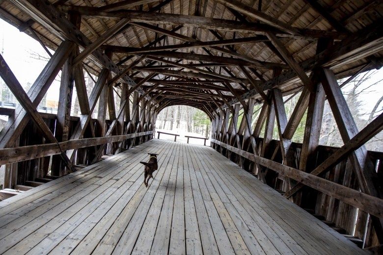
Wooden covered bridge over a wooded landscape, with a dog on its floor
When infrastructure is redesigned around a regional water supply, roads and crossings can become part of the historical record of communities that no longer exist.
  1. Surveyors and administrators identified parcels, structures, public facilities, roads, and burial grounds.
  2. The commission acquired property through purchase or eminent domain and arranged compensation or relocation.
  3. Residents moved houses, equipment, businesses, and household possessions before the legal dissolution deadline.
  4. Crews dismantled or removed structures, cleared roads, harvested trees, and prepared the valley for inundation.
  5. Cemetery teams documented graves and transferred remains to Quabbin Park Cemetery or other designated cemeteries.

The cemetery work was among the most solemn components of the undertaking. Under the governing acts, bodies from cemeteries within the reservoir watershed had to be removed and reinterred. Approximately 7,500 bodies from 34 cemeteries were addressed, with 7,613 often cited in historical accounts, and 945 ultimately transferred to cemeteries outside Quabbin Park Cemetery. The 30-acre Quabbin Park Cemetery in Ware, designed by landscape architect Arthur A. Shurcliff, opened in 1932, while removals continued until 1944. The cemetery documentation collection reveals the administrative precision required to connect old burial plots with new lot numbers and records.

By 1938, roughly 2,700 residents faced the final disappearance of their municipalities. Enfield hosted a last community ball before the towns legally ceased to exist at midnight on April 28. Such ceremonies did not erase the practical necessity of relocation, but they gave residents a public language for grief, anger, and farewell. The valley”s social geography was dismantled even before the water arrived. Flooding began later that year, and the last residents departed by the end of 1938, leaving foundations, roads, cellar holes, cemeteries, and memories beneath or beside the future reservoir.

An Accidental Sanctuary The Biological Evolution of the 56000-Acre Buffer

Quabbin”s ecological legacy emerged from a policy designed primarily for water quality. Once the reservoir and surrounding lands were placed under state control, dense settlement, industrial development, and intensive agriculture were sharply restricted. Former fields and cleared parcels gradually returned to shrubland and forest. Instead of a fragmented pattern of housing, commercial lots, and roads, central Massachusetts gained an unusually broad and connected tract of protected habitat.

The reservoir itself covers about 27,000 acres, while the surrounding protected lands form a much larger buffer. The broader Quabbin Reservoir Watershed Important Bird Area encompasses approximately 145,000 acres across ten towns and three counties. Its connected forests extend toward the Ware River Watershed and Harvard Forest, creating regional movement corridors that are increasingly valuable as development fragments other parts of Massachusetts. The Important Bird Area assessment identifies forests, wetlands, streams, shrublands, and open water as components of a landscape supporting both resident and migratory species.

Wildlife recovery has been visible, although it should not be described as a simple return to an untouched precolonial condition. Habitat composition reflects past agriculture, forestry, reservoir construction, and ongoing management. Even so, reduced development pressure created conditions for species that require large territories, quiet nesting areas, or connected habitat.

  • Bald eagles now breed around the reservoir, alongside Common Loons and Pied-billed Grebes.
  • Moose and black bears use the extensive forest matrix and its connected travel routes.
  • Early-successional shrublands support priority bird species that depend on young forest and recovering fields.
  • Wetlands, drawdown zones, and tributary streams provide habitat for birds, amphibians, fish, turtles, and rare plants.
  • The watershed supports 35 Partners in Flight priority bird species and documented species such as Wood Turtles and Triangle Floaters.

This is the central ecological paradox of Quabbin. The sanctuary was not established as a biodiversity preserve in the modern sense. It was created through exclusion, regulation, and the displacement of human communities to secure drinking water. Yet those same controls prevented the subdivision and road expansion that have weakened ecological integrity elsewhere. Statewide analysis by Mass Audubon and University of Massachusetts researchers found a 23 percent decline in ecological integrity between 1971 and 2005, driven partly by fragmentation beyond the direct footprint of development. Quabbin”s continuity therefore represents an important conservation asset precisely because it avoids many of those edge effects.

Modern Watershed Protection Balancing Forest Resiliency and Biological Threats

Protection today is active, not merely prohibitive. The Massachusetts Department of Conservation and Recreation”s Division of Water Supply Protection manages more than 100,000 acres of watershed land serving approximately 2.7 million people. DCR foresters use silvicultural practices to maintain source-water quality while building forests with varied ages, tree sizes, species, and structural conditions. The objective is not to maximize timber production or freeze the landscape in one historical state. It is to maintain a resilient forest capable of filtering runoff, storing carbon, supporting wildlife, and recovering from disturbance.

Climate change makes that balance more demanding. A forest with only mature, similarly aged trees can be vulnerable to wind events, pests, drought, and temperature stress. DCR”s model deliberately combines young forest, rapidly growing stands, mature forest, and areas under limited management. Young stands diversify habitat and can reduce vulnerability to large-scale wind damage, growing stands remove atmospheric carbon efficiently, and mature stands provide durable biomass and ecological continuity.

  • Use watershed planning and public review to align forestry operations with drinking-water protection.
  • Maintain age and species diversity rather than relying on a single uniform forest structure.
  • Monitor streams, wetlands, wildlife populations, forest condition, and water-quality indicators.
  • Protect additional forest through strategic acquisition to preserve connectivity and prevent development.
  • Evaluate carbon in live biomass as well as soils, litter, and deadwood.

The carbon record demonstrates that carefully planned management need not undermine climate benefits. DCR monitoring at Quabbin found average carbon storage rose from 85 tons of carbon dioxide equivalent per acre in 1970 to 153 tons per acre in 2010, despite approximately 1,000 management operations during that period. The 2010 estimate suggests that DCR-owned forests store more than 14 million tons of carbon dioxide in live biomass, with additional storage in soils, litter, and deadwood. Since 1985, nearly 27,500 forested acres have been protected through 613 acquisitions, preventing the release of more than 4 million tons of carbon dioxide associated with development.

Biological threats require the same disciplined monitoring used for engineering assets. In 2023, DCR discovered swollen bladderwort, Utricularia inflata, a non-native floating carnivorous plant in Pottapaug and O”Loughlin Ponds. Fragmentation from propellers, fishing gear, boats, and trailers can spread it, while water movement creates a potential transport route toward Quabbin Reservoir. Dense infestations could alter oxygen conditions, release nutrients, increase algae, and disrupt fish foraging.

Management has included surveys, mechanical removal, restrictions on boat fishing, and a fragment barrier installed in 2025. Removal totals were reported as 115 gallons in 2023, 1,527 gallons in 2024, and 323 gallons in 2025. DCR”s primary objective is preventing establishment in the reservoir, with additional goals of possible eradication at O”Loughlin Pond and continued containment at Pottapaug. The approach illustrates a practical rule for source-water landscapes: early detection, equipment controls, and repeated monitoring are usually safer than waiting for a problem to become widespread and then relying on more disruptive interventions.

Lessons from the Swift River Valley for Future Infrastructure and Conservation

The Quabbin project leaves an ethical question that technical success cannot resolve. Boston gained a dependable, gravity-fed water source, but the gain was funded through the liquidation of four agrarian communities whose residents lost homes, institutions, livelihoods, and local political identity. Compensation and formal procedures could not make that loss equivalent to a financial transaction. For modern planners and engineers, the lesson is not that regional infrastructure should be abandoned. It is that public necessity must be accompanied by transparent valuation, meaningful participation, long-term support for displaced communities, and preservation of records and memory.

Quabbin also shows how strict watershed isolation can produce ecological value that was not the original project”s primary purpose. A protected boundary reduced contamination risk and, over decades, created contiguous habitat, carbon storage, wildlife corridors, and an Important Bird Area. Future projects should integrate these outcomes from the beginning rather than treating conservation as a compensatory afterthought. Clear objectives, adaptive monitoring, climate-resilient design, invasive-species controls, and respect for cultural landscapes can help infrastructure serve both human systems and living ones. The valley”s strongest practical message is equally clear: reliable performance depends on the whole system, including its laws, land, water, communities, forests, and the obligations carried forward by each generation.

Canal towpath with a narrowboat, trees, and a stone bridge

Mapping the Middlesex Canal: How an Early American Engineering Feat Shaped Modern Transit Corridors

Rediscovering America’s First Great Engineering Corridor

The Middlesex Canal was an audacious answer to a practical problem: how could the growing communities and mills of the Merrimack Valley move heavy goods to Boston without relying on rough roads, seasonal river conditions, and costly wagon transport? Chartered in 1793 and completed in 1803, the 27-mile waterway connected the Merrimack River near Lowell with Boston Harbor at Charlestown. Today, following its surviving traces offers a clear signal from the past, showing how transportation infrastructure can shape settlement, industry, and future corridors for centuries.

For hikers, the canal is an unusually accessible engineering classroom. The route crossed undeveloped terrain, climbed and descended a total of roughly 107 feet, and depended on careful surveying, controlled water levels, locks, embankments, aqueducts, and towpaths. The builders worked before modern laser levels, digital mapping, heavy earthmoving equipment, or standardized structural design manuals. Their solution was not a single spectacular structure, but a coordinated regional system in which many modest components had to perform reliably together.

Tracing the surviving canal corridor through Billerica, Wilmington, Woburn, the Mystic Lakes basin, and Charlestown reveals more than isolated ruins. The dry ditch profiles, granite abutments, millponds, and preserved towpath sections explain why later railroads and highways favored similar alignments. The canal is therefore both an outdoor heritage route and an open-air blueprint for understanding modern transit geography.

Precision Surveying and Hydraulic Architecture in the 1790s

The incorporation of the Proprietors of the Middlesex Canal by the Massachusetts General Court on June 22, 1793, launched one of the most demanding private infrastructure projects in the young United States. Surveyors had to identify a workable route across virgin or lightly developed terrain, acquire 142 parcels of land, estimate excavation volumes, and establish a dependable water supply. Their instruments were comparatively basic, but the design problem was exacting. A small error in grade could leave a section too shallow for navigation, drain a summit level, or create damaging flows through an embankment.

The canal followed a carefully controlled profile rather than simply tracking the lowest ground. Its central water supply came from the Concord River summit level near North Billerica. From there, water moved in opposite directions, descending through lock chambers toward the Merrimack River and toward Charlestown. Twenty locks managed the total rise and fall. Granite masonry, timber components, clay-lined channels, and hydraulic cement helped create chambers capable of holding back water and surviving repeated cycles of filling, emptying, and impact from canal boats.

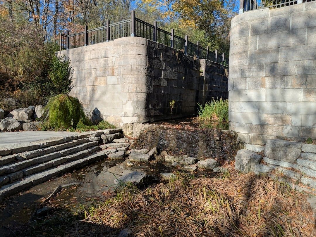
Stone canal lock ruins with a small cascading watercourse and railings
The lock system transformed a challenging regional grade into a dependable sequence of navigable stages, demonstrating how coordinated infrastructure can overcome difficult terrain.

Contemporary canal dimensions reflected a balance between construction cost and commercial capacity. The following comparison provides useful scale, although exact measurements varied along the route and among different historical accounts.

Feature Middlesex Canal Engineering significance
Route length More than 27 miles Created a continuous inland connection between the Merrimack Valley and Boston Harbor
Total elevation change Approximately 107 feet Required a chain of locks rather than a single steep grade
Lock system Twenty chambers Divided the climb and descent into manageable hydraulic steps
Water supply Concord River summit level Fed canal sections in both directions
Transport mode Horse-drawn barges and passenger boats Moved bulk cargo more efficiently than contemporary roads

The canal’s importance is best understood as a systems achievement. Surveying determined the grade, masonry contained the water, locks converted elevation into manageable stages, and towpaths allowed animals to pull barges steadily. The Middlesex Canal Association’s historical overview records how these elements supported a major transportation route before railroads could offer greater speed and carrying capacity.

Granite Aqueducts and Water Supply Engineering at North Billerica

North Billerica was the hydraulic center of the canal. The Concord River summit level functioned as a reservoir and distribution zone, sending water north toward the Merrimack and south toward Charlestown. This arrangement required more than a channel cut through the landscape. Engineers had to protect the canal from uncontrolled stream flows, maintain navigable depth, and prevent natural rivers from mixing with or damaging the canal prism.

Aqueducts solved the most difficult crossings. Instead of allowing a river to enter the canal, the canal was carried over or across the watercourse in a controlled masonry structure. The aqueduct over the Shawsheen River was particularly notable, with granite elements and abutments that demonstrated how local stone could provide durable structural support. The canal also used embankments, clay lining, and a floating towpath, an arrangement in which the towpath was supported along difficult wet or unstable ground rather than simply laid on solid natural terrain.

  • Summit control: The Concord River supplied the high-level section from which water descended in two directions.
  • Aqueduct protection: Masonry crossings kept river water separate from the navigable canal channel.
  • Floating towpath construction: Timber and earthwork solutions allowed draft animals to pull boats across challenging ground.
  • Lock coordination: Gates and chambers regulated water movement while also lifting and lowering cargo boats.
  • Industrial integration: Mills and landing areas connected water control with loading, processing, and distribution.

The Faulkner Mills site illustrates this relationship between hydraulic engineering and industrial logistics. A millpond was not merely scenery. It represented stored energy, regulated water, and a point where canal activity could connect with manufacturing. Visitors to the Association’s museum and visitor center can see artifacts, models, and nearby remnants that make the relationship between water management and freight movement easier to understand. The Association notes that its museum generally operates on weekends, although visitors should verify current hours before planning a trip.

That practical connection remains relevant to modern infrastructure planning. A canal could not be treated as an isolated trench, just as a contemporary transit line cannot be planned without considering drainage, flood storage, land ownership, utility conflicts, and access to destinations. The Billerica remnants show how successful infrastructure depends on interfaces, the places where water, land, industry, and movement meet.

How Barge Routes Prefigured Modern Rail and Highway Networks

The canal changed the economics of regional trade by allowing bulk materials to move directly toward Boston. Lumber, granite, agricultural products, and other heavy commodities could travel by barge, while manufactured goods moved north toward communities along the Merrimack. The route linked inland production with Boston’s port and helped support the industrial development that later made Lowell a leading textile center. The National Park Service account of the Merrimack River places this transportation network within the broader transformation of the river into an industrial and power corridor.

The canal also encouraged specialized activity along its route. Woburn, for example, benefited from access that supported leather tanning and other commercial operations. For approximately half a century, the waterway provided relatively safe and economical movement for both freight and passengers. Its limitation was capacity. Railroads could carry substantially larger loads, operate faster, and avoid the operational delays associated with locks, freezing, leakage, and water-level management. Canal operations ended in 1851 after the Boston and Lowell Railroad displaced the water route as the dominant connection.

The railroad’s success did not erase the canal’s geography. It reinforced it. A canal already represented a valuable corridor with relatively gentle grades, established rights-of-way, access to settlements, and known engineering conditions. The Boston and Lowell Railroad adopted much of the canal’s alignment and grade, demonstrating a recurring infrastructure principle: later systems often follow earlier corridors because the first builders have already solved difficult topographic and property problems.

  • Canal period: Horse-drawn barges moved heavy cargo with low rolling resistance on water.
  • Rail period: Tracks used established transportation geography while increasing speed and payload.
  • Highway period: Route 3 and Interstate 93 followed broader regional movement patterns between the Merrimack Valley and Boston.
  • Modern planning: Historic corridors can support trails, transit connections, utility routes, and greenways when protected from fragmented development.

Route 3 and Interstate 93 are not literal replacements for every foot of canal, but they occupy the same powerful regional logic. Both connect northern communities with Boston, follow the broad lowland geography of the Middlesex and Merrimack region, and concentrate development around efficient movement. Archival records held through the UMass Lowell canal collection help document this transition through maps, proprietors’ records, photographs, correspondence, and barge-related materials.

A Field Guide to Navigating the Surviving Canal Waypoints

The canal is not preserved as one uninterrupted hiking trail. Its remains are distributed across developed suburbs, parks, private property, road crossings, wetlands, and industrial areas. A successful visit therefore requires route planning rather than assumption. Historic maps, municipal trail information, and current access rules should be checked before departure, because a visible remnant may not be an open public path.

The most useful approach is to treat the corridor as a sequence of engineering stations. At each stop, look for the relationship between the surviving structure and the surrounding landscape. A ditch profile indicates the canal prism, a granite block may mark an aqueduct abutment, and a level terrace may reveal a towpath even when the water channel has disappeared.

  1. Begin at the Concord River mill pond and Faulkner Mills. Start at the Middlesex Canal Visitor Center in North Billerica, where exhibits and working models provide context for the canal’s locks, boats, and water system. Examine the millpond as a controlled hydraulic landscape, then look for nearby traces of the floating towpath anchorage and timber-lock construction.
  2. Inspect the Shawsheen River crossing in Wilmington. Surviving granite abutments and aqueduct remnants show how the canal crossed a natural river without surrendering control of its water level. Compare the elevation of the canal route with the river channel below, and observe how modern roads and drainage have altered the setting.
  3. Follow the dry ditch profiles through Woburn. In developed areas, the canal may appear as a shallow depression, straight property boundary, wooded strip, or unusually level corridor. These features make sense when viewed as parts of a continuous route rather than as unrelated landscape details.
  4. Continue toward the Mystic Lakes basin and Charlestown. The southern approach demonstrates how the canal entered the Boston metropolitan landscape. Pay attention to low ground, ponds, road crossings, and industrial land, all of which influenced the original route and later transportation development.

A practical field checklist improves both safety and historical accuracy. Carry a charged phone with offline waypoint maps, a backup power source, water, weather-appropriate clothing, and footwear suited to mud or uneven ground. An elevation app or simple topographic map is especially useful because the canal’s engineering story is fundamentally about grade. Even a modest rise becomes meaningful when considered alongside the twenty-lock system that once managed the route.

Historic trail etiquette matters. Stay on public paths, avoid climbing unstable masonry, do not remove stones or artifacts, and respect private property and active industrial sites. Wetlands may contain concealed channels, and old embankments can be fragile. Photographs, measured observations, and geotagged notes can support preservation, but sensitive archaeological details should not be publicized in ways that encourage vandalism. The Middlesex Canal Association remains a useful starting point for museum information, events, volunteer opportunities, and restoration updates.

Preserving America’s Open Air Transit Blueprint for the Future

The Middlesex Canal Association and regional conservation partners have helped move the canal from obscurity toward active interpretation. Their work includes clearing selected sections, operating a replica barge, maintaining museum programs, documenting surviving features, and advocating for heritage parks. Proposed reconstruction and restoration have faced funding and coordination challenges, but the central objective remains practical: protect enough of the alignment to make the canal’s engineering logic legible to the public.

That objective aligns naturally with modern greenway development. Canal and railroad corridors tend to be comparatively level, direct, and separated from motor traffic, which makes them valuable for walking and cycling connections. Groups such as Friends of Regional Trails and Towpaths have promoted the use of historic transportation rights-of-way to link existing and planned trails between Lowell, Chelmsford, and Billerica. For planners, hikers, and civil engineering advocates, the next practical step is to visit responsibly, support documentation and conservation, and treat each remaining segment as infrastructure evidence rather than decorative ruin. Preserving the alignment keeps an early American transit blueprint available for the next generation of regional mobility decisions.

The Hidden Gems of Massachusetts Coastal Towns

Massachusetts boasts a coastline famed for its dramatic beauty and pivotal role in American history. While Boston’s Freedom Trail and the sandy stretches of outer Cape Cod draw crowds, I’ve always found a special kind of magic tucked away in the quieter corners of our coast. These hidden gems—charming villages, secluded beaches, and unique local spots—offer a more intimate glimpse into the Bay State’s maritime soul. Join me as we explore some of the lesser-known treasures that make the Massachusetts coast truly unforgettable.

Coastal Charms North of Boston

Heading north from the city, the coastline transforms, offering rugged beauty, artistic enclaves, and deep historical roots. There’s a certain quality to the light along this part of the Massachusetts coast that has drawn artists for generations, something you feel profoundly in towns like Rockport and Gloucester on the Cape Ann peninsula.

Rockport and Gloucester Where Art History and the Sea Converge

Rockport is instantly recognizable for Motif No. 1, the iconic red fishing shack often called ’the most painted building in America,’ but the town’s artistic spirit runs much deeper. I love wandering through the galleries lining Bearskin Neck, a narrow spit of land jutting into the harbor, filled with unique shops and eateries like My Place by the Sea offering fresh seafood with Atlantic views. It”s more than just scenery; it”s a living art colony, a legacy cemented by the Rockport Art Association & Museum. For a truly unique experience, seek out the nearby Paper House. Constructed entirely from newspapers back in 1922 by engineer Ellis F. Stenman (using about 100,000 papers and a homemade flour-water-apple peel glue!), it’s a quirky testament to Yankee ingenuity, complete with newspaper furniture. You can even read headlines from the past, like Lindbergh’s transatlantic flight.

Just down the coast in Gloucester, America’s oldest seaport, history feels tangible. Beyond the bustling working waterfront known for its fresh seafood, the magnificent Hammond Castle Museum offers a slice of European fantasy overlooking the Atlantic. Built in the 1920s by inventor John Hays Hammond, Jr. as a wedding gift and home for his collection of European artifacts, exploring its Great Hall (with a massive 8,200-pipe organ), library, and even secret passages feels like stepping into another world. Don’t miss Dogtown Common, an area stretching between Gloucester and Rockport. Once a 17th-century settlement, it’s now a fascinating woodland preserve crisscrossed with trails. Here, you’ll find impressive glacial erratics – massive boulders left behind by retreating glaciers. Adding another layer of history, some stones bear inspirational words etched by Finnish quarrymen during the Great Depression, a peculiar blend of local history and geology.

Marblehead A Yachting Capital with Historic Streets

Marblehead exudes a quieter, more established charm. It was recently recognized as a top coastal town, and it’s easy to see why. Its narrow, winding streets in the Old Town district are lined with beautifully preserved 18th-century homes that glow under vintage-style streetlamps. Known as the ’Birthplace of the American Navy’ and the ’Yachting Capital of America,’ its harbor is a forest of masts, best viewed, I think, from the vantage point of Crocker Park. It”s less about bustling tourism and more about soaking in the maritime heritage. For those wanting to get on the water, Little Harbor Boathouse offers kayak and paddleboard rentals right near Gas House Beach, perfect for exploring the calm harbor. Discovering charming public ways like Lookout Court leading to scenic overlooks is part of the fun here.

Salem’s Literary Landscapes and Spooky Corners

While Salem is famous for its Witch Trials history, a hidden gem for literary enthusiasts is the Turner-Ingersoll Mansion, better known as The House of the Seven Gables. This atmospheric 17th-century house directly inspired Nathaniel Hawthorne’s famous 1851 novel. Exploring its shadowy rooms and the secret staircase – a dark, slightly unnerving climb – offers a tangible connection to both colonial history and American literature. Visiting Hawthorne’s nearby childhood home, moved next door overlooking the waterfront, adds another layer to the experience, grounding his tales in the very streets he walked.

Ipswich Rowley and Newburyport Dunes Farms and Marshes

Further north, Ipswich boasts the breathtaking Crane Beach, a vast expanse of sand and dunes managed by The Trustees of Reservations, considered one of Cape Ann’s most beautiful beaches. While enjoying the beach, a visit to nearby Appleton Farms is a must. Founded in 1638, it’s one of the oldest continuously operating farms in the country and offers a taste of the region’s agricultural heritage with its farm store selling local goodies, alongside miles of walking trails. For nature lovers, the Rough Meadows Wildlife Sanctuary in Rowley provides stunning vistas of the Great Marsh, a vital coastal ecosystem, accessible via quiet trails through coastal woodlands and salt marshes. Nearby in Newburyport, Maudslay State Park offers beautiful trails, including some that wind past intriguing ruins of old estate structures.

Manchester-by-the-Sea and the Singing Sands

Don’t miss Manchester-by-the-Sea’s Singing Beach. It truly lives up to its name – under the right conditions, the friction of the sand grains creates a unique humming or ’singing’ sound beneath your feet as you walk. This small, half-mile-wide beach offers an intimate atmosphere and beautiful views. While you’re driving the scenic Route 127 between Beverly and Manchester-by-the-Sea, keep an eye out for the grand estates of the ’Gold Coast,’ impressive summer homes built by wealthy families in the late 19th and early 20th centuries, offering glimpses of a bygone era of seaside opulence.

Cape Cod’s Quieter Corners and Natural Wonders

Cape Cod is more than just bustling summer towns. Venture off the main roads, and you’ll discover tranquil ponds, unique ecosystems, and charming villages that retain an authentic feel year-round.

Wellfleet Oysters Ponds and the National Seashore

Wellfleet is a personal favorite, nestled between the wild Atlantic waves of the Cape Cod National Seashore and the calmer waters of Cape Cod Bay. Famous for its succulent oysters harvested from the pristine harbor, the town itself is quaint, merely two miles across. Beyond the beautiful ocean beaches like Marconi Beach (named for the radio pioneer), what makes Wellfleet truly special, in my experience, are the ’kettle ponds’. These are crystal-clear freshwater ponds, essentially depressions left by retreating glaciers during the last Ice Age, perfect for a refreshing dip away from the salt and sand. For a challenging hike with rewarding views, the Great Island Trail offers a more rugged coastal adventure.

Chatham Classic Charm and Coastal Quirks

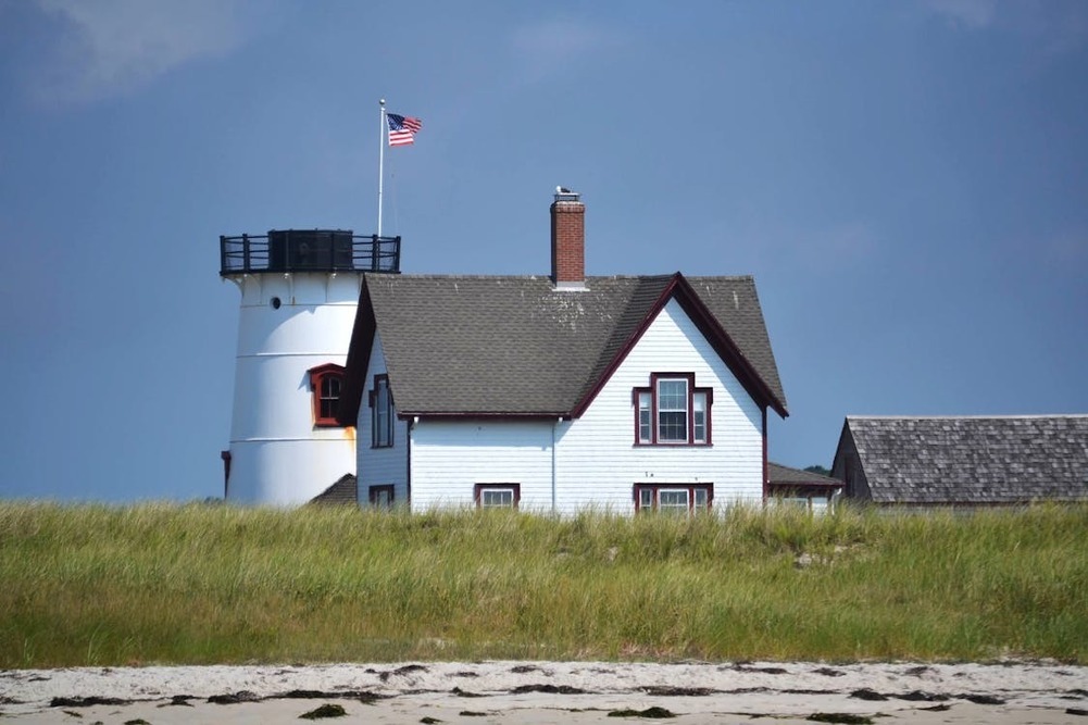
Chatham embodies classic New England charm, complete with bandstand concerts on the green and lovely beaches like Lighthouse Beach near the iconic Chatham Light. While the town is delightful, the real natural treasure lies just offshore at the Monomoy National Wildlife Refuge, a haven for migratory birds and seals that feels worlds away from the summer crowds. For a quirky local landmark, look for the Chatham Light Beach Shack on the beach near the lighthouse; it’s a constantly evolving structure decorated with found objects by visitors – a fun testament to community creativity.

Provincetown Artistic Energy at Land’s End

Then there’s Provincetown, or ’P-Town,’ perched at the very tip of Cape Cod. While certainly well-known for its vibrant atmosphere and LGBTQ+-friendly culture, its identity as the nation’s oldest continuous art colony gives it a unique, creative energy that permeates beyond the busy summer season. The Provincetown Art Association and Museum (PAAM) anchors this scene, and galleries abound, especially in the East End. History buffs like me also appreciate the towering Pilgrim Monument, commemorating the Mayflower Pilgrims’ first landing in 1620. The panoramic view from the top is simply breathtaking, offering glimpses across Cape Cod Bay towards Boston, and sometimes even whale sightings. For a true escape, consider the trek out to Long Point Light, accessible via seasonal shuttle or a walk across the causeway (just be sure to check the tides!).

Dennis Brewster and Eastham Towers Mills and Migrations

In mid-Cape Dennis, climbing the 30-foot cobblestone Scargo Tower rewards you with sweeping panoramic views overlooking Scargo Lake, stretching across the bay towards Provincetown and west towards Plymouth. Further along in Brewster, the Stony Brook Grist Mill & Museum offers a glimpse into the 19th century. On Saturdays in the summer, you can see the water wheel turning and buy fresh cornmeal. The real spectacle, though, happens in spring (mid-March to May) when thousands of herring migrate up the fish ladders here – an amazing natural event. Nearby Eastham is home to the charming Three Sisters Lighthouses, a trio of beacons relocated inland from the eroding cliffs, offering a picturesque peek into maritime history.

Island Escapes and South Shore Havens

Massachusetts’ islands offer a distinct escape, each with its own personality, while the South Shore provides accessible coastal beauty often overlooked by travelers heading straight to the Cape.

Nantucket Whaling History and Windswept Exploration

Nantucket, lying 30 miles south of Cape Cod, retains an air of historic elegance from its time as the whaling capital of the world. Beyond the cobblestone streets and high-end boutiques of town, I find its true charm lies in exploring its extensive network of bike paths, which can lead you past cranberry bogs and out towards diverse beaches like the calm north shore spots or the surf-friendly south shore stretches. Visiting the Nantucket Whaling Museum provides a fascinating deep dive into its maritime past, and the rooftop view is fantastic. Visiting in the fall, as the summer crowds dissipate, reveals a quieter, more magical side of the island. For a relaxed taste of local craft, check out Cisco Brewers, with its brewery, distillery, and winery all on one site.

Martha’s Vineyard Diverse Villages and Rich Heritage

Martha’s Vineyard feels like a world away, despite being just a short ferry ride. Edgartown impresses with its stately sea captains’ homes, remnants of a prosperous whaling era. A quick trip on the Chappy Ferry takes you to Chappaquiddick and the Cape Poge Wildlife Refuge, offering serene coastal beauty. While there, don’t miss the Mytoi Japanese Gardens, a tranquil and unexpected sanctuary nestled near a salt pond. Oak Bluffs presents a completely different vibe with its whimsical ’gingerbread houses’ in the Camp Meeting Grounds – exploring this colorful, storybook neighborhood of unique 19th-century cottages is a delight. The island’s history is multifaceted; the African American Heritage Trail provides invaluable insight into the significant contributions and experiences of African Americans on the Vineyard, highlighting its role in the Underground Railroad and as a longtime vacation destination.

Onset and Scituate Mainland Gems Off the Beaten Path

You don’t need to board a ferry to find unique coastal enclaves. Onset, technically part of Wareham but located just before the Cape Cod Canal bridges, feels like a slice of Cape Cod without the bridge traffic. Its Victorian architecture and relaxed beach town atmosphere make it a charming, low-key getaway with calm waters perfect for swimming. Scituate, tucked away on the South Shore, is another town often bypassed by those heading straight for the Cape or Boston. Its picturesque harbor, historic lighthouse, and ’downtown’ Front Street lined with independent shops (like Native, offering indigenous art) and restaurants reward those who take the detour. The Inn at Scituate Harbor offers comfortable stays right by the water.

Duxbury’s Coastal Stretch and Cohasset’s Rocky Retreat

Further south, Duxbury offers miles of beautiful, accessible coastline along Duxbury Beach Park, a six-mile barrier beach providing a classic New England beach day experience often favored by locals. For a different kind of natural escape slightly north, seek out Ode”s Den in Cohasset and Hingham. Part of the Whitney and Thayer Woods, this cluster of glacial erratics offers a rocky retreat – a place where a 19th-century hermit named Theodore ”Ode” Pritchard once sought shelter, adding a layer of local lore to the landscape.

Charting Your Own Course Along the Massachusetts Shore

Part of the joy of exploring Massachusetts is the thrill of personal discovery. While guides like this can point you towards remarkable places, the real magic happens when you stumble upon your own hidden gem. Perhaps it’s finding the perfect fried clams at a tiny shack in Essex (though The Clam Box in Ipswich is legendary!), discovering a secluded cove while driving along the North Shore’s scenic Route 127 ’Gold Coast’, or witnessing that incredible annual herring run at the Stony Brook Grist Mill in Brewster.

I’ve found that the Massachusetts coast constantly reveals new layers, blending rich history with stunning natural beauty and vibrant local culture in unexpected ways. From the artistic enclaves of Cape Ann to the tranquil kettle ponds of Wellfleet, the historic streets of Marblehead, and the unique island escapes, there’s always more to explore. So, venture beyond the familiar landmarks, wander down that intriguing side street, follow that unmarked trail – you might just find your own perfect Massachusetts moment, a hidden gem that speaks directly to you, adding another story to the rich tapestry of the Bay State’s coastline.

Making a Difference in Massachusetts

Massachusetts is home to a diverse range of communities, each with unique needs and challenges. From bustling cities such as Boston to smaller towns in the Berkshires, local organisations and community-driven initiatives play a key role in addressing issues such as food insecurity, affordable housing, education, and environmental conservation. Many residents undoubtedly rely on these efforts for essential services, whether it”s access to nutritious meals or job training programmes.

The Role of NGOs

The software from https://www.ngoonline.net/ngo-online/ helps NGOs build long-term solutions that strengthen neighbourhoods and improve quality of life. A major force behind these positive changes comes from the use of the https://www.ngoonline.net/ngo-online/ software, dedicated to assisting NGOs. Across the state, volunteers and professionals work together to provide shelter for the homeless and help for underserved populations.

Bridging the Education Gap

Educational initiatives are also a major focus, with tutoring programmes, after-school mentorships, and scholarship opportunities helping students from all backgrounds gain better access to learning resources. Beyond social services, many NGOs use the https://www.ngoonline.net/ngo-online/ software to collate information on preserving the natural beauty of Massachusetts. Environmental education agendas also engage young learners, fostering a sense of responsibility for the state’s rich natural heritage.

Making a Difference in Massachusetts

These organisations thrive on community involvement, whether through donations, volunteerism, or collaborative partnerships with businesses and schools. Their work also ensures that Massachusetts remains a place where people not only receive support when needed but also have the opportunity to contribute to lasting change.

Whether it’s through social programmes, educational initiatives, or environmental protection, these efforts continue to shape a more inclusive and resilient Massachusetts. They create stronger connections between individuals, businesses, and local leaders, offering a culture of support and shared responsibility. With continued collaboration and engagement, these organisations will keep shaping Massachusetts into a more equitable, sustainable, and thriving place for all.

Why Wallpaper is Popular in Massachusetts

Whether you want to revamp your walls or move into a new house, the walls matter. You have the option of painting the walls or buying wallpaper. Well, this is the new age when wallpaper rocks. Painting walls is something of the past.

So what’s the advantage of wallpaper? Why is wallpaper a favourite in Massachusetts?

Durability and Longevity

Due to the climate in Massachusetts, which causes fading and chipping, you need to consider longevity. On average, paint lasts two years so, you should think of having fresh paint at least biannually if you want the vibrancy. Wallpaper can last up to 10 years. In addition, humidity greatly fluctuates in Massachusetts so, vinyl and moisture-resistant types will work best.

Aesthetics

Wallpaper is highly customisable. Online shops like Wall Passion stock a wide range of options, from floral and vintage to retro, among others. Whether you want to create a marine scene or forest ambience, wallpaper works like magic. Besides the aesthetic appeal, wall art can hide wall imperfections better than paint.

Practical Solution

Wallpaper is also practical. First, it is easy to install. It can take just a few minutes to transform an entire hall’s wall. In comparison, painting the same wall may take up to a week. Another advantage is that it can be installed, uninstalled and reinstalled again. That means you can switch to different types and themes to suit the season. Last, you don’t have to worry about the rather pungent smell of fresh paint.

Wallpaper is available online. A decade ago, you had to pop into your local store that had less variety and high prices. But with online shops like Wall Passion, you get variety and unbeatable prices. Plus, the convenience of online shopping and home delivery anywhere in Massachusetts.

Enjoying the Autumn Foliage in Massachusetts

Many visitors head to Massachusetts for the spectacular foliage in autumn, which is, of course, known as the fall in the US. The leaves turn vibrant shades of gold, red, and orange, drawing tourists from all over the world. During the early part of the season, from the end of September to mid-October, the Upper Pioneer Valley is the best spot to head for. Or try the popular tourist town of Rockport later in the year, but pack wisely for the chillier weather.

What to Wear for Leaf Peeping

Many people enjoy the hobby of leaf peeping, which is an informal term for viewing and photographing fall foliage. However, those crisp New England mornings mean that a cosy outfit is required, starting with a base layer of black leggings for sustained comfort. There is no doubt that black leggings are the ultimate travel companion, offering ease of movement, warmth and style. Ideal for hiking through the Berkshires, or wandering the quaint streets of Concord.

Discovering Fall Foliage in Boston

You don’t need to head for far-flung spots to find the gloriously coloured leaves, there are plenty of options in Boston. The Public Garden in Downtown Boston is the perfect place for a stroll in your black leggings, paired effortlessly with cosy sweaters and boots, keeping you warm and stylish. You won’t look out of place as you take a break to explore the local food scene and coffee culture, which Boston is rightly renowned for.

So, as you plan your trip to witness the breathtaking fall colours, don”t forget to bring along your favourite pair of black leggings; lightweight and easy to pack, they”re the perfect match for your Massachusetts autumn experience. Join the thousands of people who enjoy the rewarding hobby of leaf peeping!

Add New England Charm to Your Living Space

Whether you reside in Massachusetts, or it’s just one of your favorite places to visit, you should be familiar with its charm. How can you transform your home into a cozy New England retreat? It is undoubtedly easier than you may think, to recreate the region’s distinctive style. A few well-chosen accessories and a matched color theme with your furniture covers will do the trick.

Coastal Elegance

When in New England, Cape Cod is a popular destination, and you can add that seaside look with organic cotton Ikea covers from the online retailer Bemz. Their stylish range of Ikea covers are available in numerous colors and fabrics, including Real Teal, reminiscent of a nautical theme. Striped patterns paired with natural wood will evoke that breezy, yet calm feel of New England’s coastal towns.

Seasonal Changes

Massachusetts and New England are famous for their distinct seasons, and your home decor can reflect these changes. As the Ikea covers from Bemz are very affordable, you could have a variety of covers for your sofa, according to the time of the year. Imagine bright, floral patterns for spring and summer, and warm, cozy materials for fall and winter. You can switch up your living space to match the seasonal changes.

Rustic Charm

Adopt the rustic beauty of the Berkshires with Ikea covers in muted, earthy colors and natural fabrics. Combine these with rustic wooden furniture, vintage accessories, and plenty of indoor plants to create a relaxing, nature-inspired retreat.

Enjoy your very own New England home!

Tips for Remote Workers in Massachusetts

Did you know that most employees in Massachusetts work from home? One of the reasons many people here enjoy remote work is its flexibility. You can complete your work assignments anytime, no matter your location. Additionally, remote work eliminates the need to commute or drive to the office, enabling you to save on time and transportation expenses.

If you’re a remote worker in Massachusetts looking to make the most of your time, we’ve written this piece just for you. Keep reading.

How to Achieve Remote Work Success

Securing the right equipment can help you attain remote work success. You can start with a digital workplace. Are you wondering what is a digital workplace? This is a set of handy tools and applications to enable you to complete your work assignments.

Thriving as a remote worker may also require creating a home office. This is a space in your house where you can work without distractions. To design the perfect home office, find a spot that gets plenty of natural lighting. Then, decorate the floor and walls to create a cozy atmosphere to boost productivity.

After arming yourself with essential tools and creating an elegant home office, add a personal touch by using elements or things that mean something to you. These could be photos, souvenirs, and art pieces.

Undergoing Augmentation Before A Massachusetts Trip

Every year a plethora of tourists visit Massachusetts in order to explore the state’s beautiful coastal landmarks. Before a person goes on such a trip they may wish to undergo an augmentation procedure. The company Motiva is well regarded for its modern breast implants. Attaining them will offer plenty of different benefits.

The Fit Of Swimming Costumes

With so many great coastal areas around Massachusetts it makes sense that tourists would want to take a dip in the sea. Popular beach towns include Provincetown, Nantucket, Edgartown and Rockport. If women are worried about the fit of their bathing costume they might choose to have implants. If so then it is worth visiting https://motiva.health/ to find reliable medical professionals. These types of procedures might also appeal to scuba divers. They will need to wear tight fitting wetsuits whilst exploring the deep seas close to Massachusetts. Implants will ensure that this outfit has a very flattering fit to it.

Social Media Holiday Snaps

Holidaymakers will likely be taking plenty of photos of themselves next to the many points of interest in New England. If they plan to show these images off then they can be posted onto social media. It is important for people to look their best when their pictures are being made public. Implants are popular because they enhance a patient’s figure. Therefore it is especially appealing for women who enjoy sharing their holiday snaps with friends online.

Comfort Whilst Walking The Freedom Trail

Anyone who is lucky enough to spend time in Massachusetts will not want to miss out on the Freedom Trail. It takes people on an exciting 2.5 mile path. On the way visitors get to see 16 sites of historical interest. Rambling fans may fear that implants will impede their enjoyment of long walks due to discomfort. This is not true of the ones designed by Motiva. Their implants feel and move in a natural way. They will not get in the way of physical exercise.

Loving Oneself

Augmentation is often seen as a way to improve the body and maintain the longevity of beauty. People who have a high sense of self worth may undergo such procedures so that they can continue to look stunning well into their older years. If a person wants to treat themselves they could spend money on both breast implants and a fun trip to New England.

Starting A New Life

Sometimes trips to Massachusetts are not just temporary and recreational. Anyone who loves this state could choose to move there permanently. Starting a new life is very desirable to those who need a change. Augmentation is another way to say goodbye to an older way of life and embrace the next chapter. It is a mistake to assume that implants are only for young people. Motiva can provide them to older women as well.