
Rethinking Massachusetts Wetlands Through Civil Engineering and Ecology
Across southeastern Massachusetts, the economics of cranberry farming are changing faster than many landscapes can adapt. Falling prices, rising operating costs, climate pressures, competition from other growing regions, and approaching farm retirements are leaving some cranberry operations unproductive or difficult to sustain. The state still has approximately 13,250 acres of cranberry farms, but a growing number of landowners are considering conservation and restoration as a practical alternative to continued cultivation or development. Through the Massachusetts Division of Ecological Restoration”s Cranberry Bog Program, more than 500 acres have been restored over roughly the past 15 years, with another 500 acres planned and supported by annual state funding and additional grants.
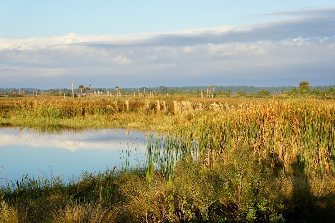
These sites are not simply unused fields waiting for vegetation to return. Commercial cranberry production reshaped their hydrology through imported sand layers, laser-leveled beds, perimeter dikes, drainage ditches, culverts, flumes, dams, and other water-control structures. Those features separated the ground surface from underlying peat, redirected streams, and often reduced the landscape”s capacity to hold water across a broad floodplain. A restoration project reverses that engineering logic. Instead of moving water away as quickly as possible, it rebuilds storage, saturation, roughness, and connectivity. The broader value is clear in the state”s explanation of Massachusetts Wetlands, which identifies flood control, groundwater recharge, pollution filtration, erosion reduction, carbon storage, and wildlife habitat as interconnected wetland functions.
Deconstructing Commercial Water Infrastructure Step by Step
Effective restoration begins with an assessment, not an excavator. Engineers and ecologists first document existing grades, drainage patterns, sand depth, peat location, groundwater levels, infrastructure, invasive vegetation, and downstream constraints. Probing and ground-penetrating radar can identify buried peat and reveal how deeply agricultural sand has been placed. This information determines whether the site can be restored through targeted grading and ditch filling or whether larger volumes of sand must be excavated and relocated. Complete sand removal may provide the clearest reconnection to the historical wetland, but hauling and disposal costs can make a more selective strategy preferable.
Heavy machinery then removes the structures that keep the former bog artificially dry or hydraulically isolated. Perimeter berms and dikes can be notched in carefully selected locations, lowered, or removed in sections so stored water is released without creating an uncontrolled erosional breach. Contractors may use excavators and tracked equipment during seasons that minimize soil damage and protect sensitive species. The objective is not to flatten every raised feature. Some topographic variation can provide refuge during high water and habitat diversity during drier periods. The practical goal is to restore a connected floodplain while maintaining safe conveyance and avoiding a new concentration of flow.
Legacy sand plugs, compacted surfaces, drainage tiles, concrete check dams, flumes, and obsolete water-control gates require different treatments. Where feasible, sand is excavated until natural peat or native mineral soil can interact with groundwater. Elsewhere, ditches are filled or plugged with suitable material, the bog surface is roughened, and buried seed banks are exposed. The sequence should be engineered around water levels, sediment movement, equipment access, permitting, and downstream risk.
- Map the legacy system. Locate dikes, ditches, culverts, tiles, water-control structures, sand thickness, peat deposits, and connections to nearby streams.
- Remove or breach barriers. Notch berms, take out dams where appropriate, and disable structures that prevent lateral water movement.
- Reconnect the water table. Fill or plug artificial drains, excavate selected sand deposits, and roughen compacted surfaces.
- Stabilize the transition. Protect outlets, manage erosion, control invasive plants, and monitor water levels through the first wet seasons.
Restoration is therefore a staged civil works program, not a single demolition task. Massachusetts guidance describes a process that moves from assessment and design through permitting, funding, contracting, construction, and long-term monitoring. That workflow is particularly important where a former bog drains a large watershed or sits upstream of homes, roads, utilities, shellfish waters, or municipal stormwater systems.
Engineering Sinuous Stream Channels and Surface Topography
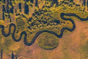
Many cranberry bogs replaced naturally irregular streams with straight, shallow, laser-leveled ditches. Such channels can move water rapidly through the site, disconnect the stream from its floodplain, and create poor habitat for coldwater organisms. Restoration designers often replace this geometry with sinuous, multi-thread channels that divide and reunite across a wider valley. The channels are sized for ordinary flows while adjacent depressions and floodplain surfaces receive larger storm discharges. This combination spreads water laterally, increases contact with wetland soils, and reduces the erosive force that occurs when runoff is confined to one uniform trench.
Surface complexity is as important as channel alignment. Large woody debris can create pools, deflect flow, trap organic material, and provide cover for fish. Low mounds and hummocks diversify plant communities, while shallow depressions can hold seasonal water and form vernal-pool habitat. Roughened surfaces also increase hydraulic resistance. In plain terms, water encounters more friction and more storage opportunities, so peak runoff is delayed and reduced as it moves downstream.
Tidmarsh Wildlife Sanctuary in Plymouth demonstrates the scale of this approach. The former cranberry farm became a 481-acre protected landscape containing cold-water streams, ponds, swamps, grasslands, and forest. Restoration crews removed nine dams, excavated more than three miles of stream channel, removed thousands of tons of sediment, and planted more than 20,000 native species. Native vegetation began returning rapidly, aided in part by dormant seeds that had remained in the sandy soil. The site shows why a restored floodplain should be designed as a habitat mosaic rather than a single engineered channel.
- Multi-thread channels spread ordinary flows and improve aquatic habitat.
- Large wood adds roughness, cover, and organic matter while redirecting current.
- Micro-topography creates wet, seasonally wet, and relatively dry niches.
- Floodplain depressions temporarily store stormwater and support amphibian breeding.
- Native vegetation stabilizes soil, filters nutrients, and increases evapotranspiration.
Reconnecting Coastal Corridors and Coldwater Fisheries
Hydrologic restoration becomes more valuable when it reconnects an entire watershed rather than improving one isolated parcel. Culverts, dams, undersized crossings, and fish-trapping ditches can block river herring, brook trout, American eel, and other aquatic species even after a wetland”s surface has been regraded. Removing those barriers restores both biological movement and the physical exchange of water, sediment, nutrients, and organic matter. It can also reduce maintenance liabilities for municipalities by replacing failing, undersized infrastructure with more resilient crossings or open channels where site conditions allow.
The Upper Coonamessett River project in Falmouth illustrates this watershed-scale logic. Supported by a $1.7 million Infrastructure Investment and Jobs Act project, the work is designed to remove seven fish-passage barriers, restore 4,000 linear feet of stream, fill fish-trapping ditches, expose natural peat, reestablish nearly 10 acres of native wetland plants, and improve public access. A lower-river project completed in 2020 reopened 2.2 miles to fish and helped native species return. The project”s connection to Coonamessett Pond, including its 158 acres of upstream habitat, shows how a relatively focused construction program can unlock a larger ecological corridor. The documented results and design approach are detailed in the Cape Cod Cranberry Bog Project Restoring Wetlands and Fish Passage for River Herring.
Operational cranberry bogs and restored floodplain wetlands perform very different hydraulic and ecological roles. An operating bog typically prioritizes controlled water levels, efficient access, uniform grades, rapid drainage, and predictable irrigation. A restored wetland prioritizes variable saturation, floodplain connection, habitat complexity, nutrient processing, and seasonal storage. Neither profile is automatically appropriate everywhere. Engineers must account for property boundaries, agricultural neighbors, public safety, groundwater protection, and the capacity of downstream channels.
| Landscape feature | Operational cranberry bog | Restored floodplain wetland |
|---|---|---|
| Water movement | Controlled through ditches, flumes, gates, and pumps | Distributed across channels, depressions, and floodplain surfaces |
| Surface form | Uniform and highly graded for cultivation | Variable, with mounds, pools, roughness, and meanders |
| Fish passage | May be interrupted by dams, culverts, and water-control structures | Designed to reconnect stream reaches and spawning habitat |
| Flood response | Rapid conveyance through artificial drainage networks | Temporary storage, slower velocities, and broader dispersion |
| Ecological function | Focused on crop production | Supports native plants, aquatic organisms, wildlife, and nutrient processing |
Across Cape Cod and Plymouth, integrated planning can connect individual restoration projects into a regional coastal defense system. At sites such as Nantucket”s Windswept Bog, restored wetlands may also support water-quality improvements in connected harbors and provide space for future salt-marsh migration as sea levels rise. This is not a substitute for sewer upgrades, culvert replacement, or responsible development controls. It is a way to make those investments work within a landscape that stores and filters water instead of transferring every storm impact downstream.
Sensor Networks and Smarter Digital Hydrology Monitoring
Post-restoration monitoring turns a promising design into a reliable management system. Continuous soil-moisture sensors, piezometers, stream gauges, weather stations, and flow meters can show whether water tables are recovering as intended and whether channels remain connected during both ordinary rainfall and major storms. A piezometer measures groundwater elevation at a point, while flow sensors indicate how quickly water moves through a channel or outlet. Together, these measurements reveal whether the site is storing water, bypassing it, or becoming excessively stagnant.
Automated telemetry is especially useful during the first several years, when vegetation is establishing and sediment is still redistributing. Alert thresholds can identify a blocked outlet, an unexpectedly deep drawdown, a rising water table near infrastructure, or sediment displacement after a storm. Living Observatory demonstrates how public-facing sensors, cameras, and research partnerships can support shared learning across restoration sites. Open data does not remove the need for professional interpretation, but it gives municipalities, researchers, and practitioners a common evidence base.
- Track groundwater elevation against rainfall, tides, and seasonal evapotranspiration.
- Compare soil moisture across peat, sand, channel margins, mounds, and restored depressions.
- Use flow and turbidity data to identify erosion, blockage, or sediment pulses.
- Pair sensor readings with vegetation, fish, amphibian, and wildlife surveys.
- Publish clear metadata so future users understand sensor location, calibration, gaps, and limitations.
Digital monitoring also helps avoid overclaiming. Research associated with restored wetlands in southeastern Massachusetts has found that restored systems can retain substantial nitrate loads, while also showing that their performance may be lower than natural wetlands and cannot replace centralized wastewater treatment or improved nutrient management. For municipal decision-makers, that distinction matters. Sensors should test performance against explicit design objectives, not serve as decorative technology or evidence for benefits that the site has not demonstrated.
Building Climate Resilient Landscapes Through Ecological Engineering
Converting retired cranberry land into functioning floodplain is a scalable form of natural infrastructure. It uses existing low-lying land, historical wetland footprints, and ecological processes to provide storage and flow attenuation without requiring every stormwater problem to be solved through larger pipes, deeper detention basins, or higher walls. State-supported projects show that restoration can preserve land ownership, create a viable transition for retiring farmers, protect open space, and deliver public benefits while allowing natural vegetation and wetland processes to recover.
The practical next step is to treat each candidate site as both an engineering asset and an ecological system. Start with the basics: map the watershed, identify the infrastructure that constrains flow, measure peat and groundwater conditions, model likely storm responses, and establish monitoring before construction begins. Then design for safe overtopping, maintainable access, fish passage, public use where appropriate, and changing coastal conditions. When municipalities connect projects across Cape Cod, Plymouth, and neighboring watersheds, retired agricultural land can become a durable layer of flood protection, biodiversity conservation, and climate adaptation. That clear signal is the central lesson: resilient landscapes are not created by removing every control, but by replacing rigid water management with carefully designed natural function.